|
Day 4-8 Convective Outlook Issued on Dec 7, 2009
Updated: Mon Dec 7 10:01:03 UTC 2009
| D4 | Thu, Dec 10, 2009 - Fri, Dec 11, 2009 |
D7 | Sun, Dec 13, 2009 - Mon, Dec 14, 2009 |
| D5 | Fri, Dec 11, 2009 - Sat, Dec 12, 2009 |
D8 | Mon, Dec 14, 2009 - Tue, Dec 15, 2009 |
| D6 | Sat, Dec 12, 2009 - Sun, Dec 13, 2009 |
(All days are valid from 12 UTC - 12 UTC) |
Note: A severe weather
area depicted in the Day 4-8 period indicates a 30% or higher probability
for severe thunderstorms within 25 miles of any point.
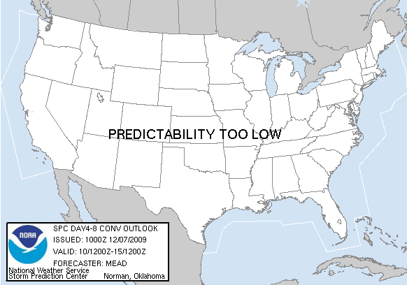
PREDICTABILITY TOO LOW is used to indicate severe storms may be
possible based on some model scenarios.
However, the location or occurrence of severe storms are in doubt
due to: 1) large differences in the deterministic model solutions,
2) large spread in the ensemble guidance, and/or
3) minimal run-to-run continuity.
POTENTIAL TOO LOW means the threat for a regional area of
organized severe storms appears highly unlikely during the entire
period (e.g. less than a 30% probability for a regional severe
storm area across the CONUS through the entire Day 4-8 period).
   ZCZC SPCSWOD48 ALL
   ACUS48 KWNS 071000
   SPC AC 071000

   DAY 4-8 CONVECTIVE OUTLOOK
   NWS STORM PREDICTION CENTER NORMAN OK
   0400 AM CST MON DEC 07 2009

   VALID 101200Z - 151200Z

   ...DISCUSSION...

   07/00Z MEDIUM-RANGE GUIDANCE IS IN GOOD AGREEMENT IN THE TRANSITION
   OF THE LARGE-SCALE PATTERN FROM THAT OF HIGH AMPLITUDE TO
   QUASI-ZONAL OVER THE CONUS BY D6 /SAT DEC 12TH/.  THROUGH THIS TIME
   FRAME...PERSISTENT LOW-LEVEL RIDGING WILL SERVE TO MAINTAIN A DRY
   STABLE AIR MASS E OF THE ROCKY MOUNTAINS EXCEPT PERHAPS ALONG THE
   IMMEDIATE GULF COAST.

   THEREAFTER...CONSIDERABLE VARIABILITY BEGINS TO DEVELOP AMONGST
   MODEL SOLUTIONS.  GFS AND A LARGE NUMBER OF THE MEDIUM-RANGE
   ENSEMBLE MEMBERS MAINTAIN A QUASI-ZONAL REGIME THROUGH THE REMAINDER
   OF THE EXTENDED PERIOD.  IN CONTRAST...THE ECMWF SUGGESTS THAT A
   HIGHER AMPLITUDE TROUGH WILL PROGRESS FROM THE ERN PACIFIC INTO THE
   CNTRL CONUS BY THE END OF THE PERIOD...SUGGESTIVE OF SOME SEVERE
   WEATHER THREAT.  GIVEN THESE MODEL DIFFERENCES...NO AREAS WILL BE
   INCLUDED IN THIS FORECAST.

   ..MEAD.. 12/07/2009

   CLICK TO GET WUUS48 PTSD48 PRODUCT
|
|


 @NWSSPC