|
Day 4-8 Convective Outlook Issued on Mar 7, 2010
Updated: Sun Mar 7 10:00:04 UTC 2010
| D4 | Wed, Mar 10, 2010 - Thu, Mar 11, 2010 |
D7 | Sat, Mar 13, 2010 - Sun, Mar 14, 2010 |
| D5 | Thu, Mar 11, 2010 - Fri, Mar 12, 2010 |
D8 | Sun, Mar 14, 2010 - Mon, Mar 15, 2010 |
| D6 | Fri, Mar 12, 2010 - Sat, Mar 13, 2010 |
(All days are valid from 12 UTC - 12 UTC) |
Note: A severe weather
area depicted in the Day 4-8 period indicates a 30% or higher probability
for severe thunderstorms within 25 miles of any point.
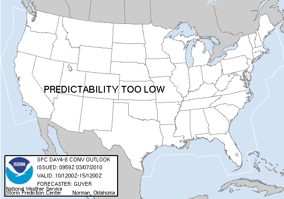
PREDICTABILITY TOO LOW is used to indicate severe storms may be
possible based on some model scenarios.
However, the location or occurrence of severe storms are in doubt
due to: 1) large differences in the deterministic model solutions,
2) large spread in the ensemble guidance, and/or
3) minimal run-to-run continuity.
POTENTIAL TOO LOW means the threat for a regional area of
organized severe storms appears highly unlikely during the entire
period (e.g. less than a 30% probability for a regional severe
storm area across the CONUS through the entire Day 4-8 period).
   ZCZC SPCSWOD48 ALL
   ACUS48 KWNS 070959
   SPC AC 070959

   DAY 4-8 CONVECTIVE OUTLOOK
   NWS STORM PREDICTION CENTER NORMAN OK
   0359 AM CST SUN MAR 07 2010

   VALID 101200Z - 151200Z

   ...DISCUSSION...
   A PROGRESSIVE SOUTHERN STREAM AIDED BY A STRONG SUBTROPICAL JET WILL
   INITIALLY PREVAIL IN THE OUTLOOK PERIOD...WITH THE INITIAL FOCUS ON
   AN EMBEDDED SHORTWAVE TROUGH THAT APPEARS LIKELY TO CROSS NORTH
   TX/ARKLATEX VICINITY TO THE TN RIVER VALLEY ON DAY 4/WEDNESDAY.
   WHILE CONSIDERABLE VARIABILITY STILL EXISTS WITH THE TIMING OF THIS
   SHORTWAVE TROUGH...GIVEN FAVORABLE WIND FIELDS JUXTAPOSED WITH A
   RELATIVELY MOIST/POTENTIALLY UNSTABLE AIRMASS...IT DOES SEEM THAT AN
   APPRECIABLE SEVERE RISK MAY EXIST ON DAY 4/WEDNESDAY ACROSS EAST TX
   TO THE NEIGHBORING ARKLATEX VICINITY/PERHAPS LOWER MS RIVER VALLEY.
   HOWEVER...AFOREMENTIONED VARIABILITY/LIMITED PREDICTABILITY
   PRECLUDES 30% DAY 1 EQUIVALENT PROBABILITIES. SOME SEVERE THREAT MAY
   EXIST DAY 5/THURSDAY ACROSS THE CENTRAL GULF COAST/SOUTHEAST
   STATES...BUT CONSIDERABLE UNCERTAINTY EXISTS AND WIDESPREAD SEVERE
   STORMS SEEM UNLIKELY AT THIS JUNCTURE.

   ..GUYER.. 03/07/2010

   CLICK TO GET WUUS48 PTSD48 PRODUCT
|
|


 @NWSSPC