|
Day 4-8 Convective Outlook Issued on Mar 21, 2011
Updated: Mon Mar 21 08:45:02 UTC 2011
| D4 | Thu, Mar 24, 2011 - Fri, Mar 25, 2011 |
D7 | Sun, Mar 27, 2011 - Mon, Mar 28, 2011 |
| D5 | Fri, Mar 25, 2011 - Sat, Mar 26, 2011 |
D8 | Mon, Mar 28, 2011 - Tue, Mar 29, 2011 |
| D6 | Sat, Mar 26, 2011 - Sun, Mar 27, 2011 |
(All days are valid from 12 UTC - 12 UTC) |
Note: A severe weather
area depicted in the Day 4-8 period indicates a 30% or higher probability
for severe thunderstorms within 25 miles of any point.
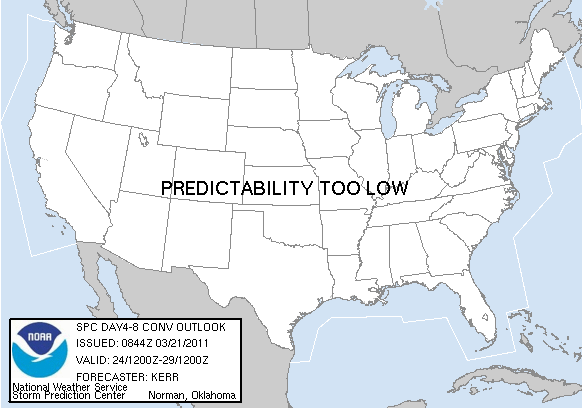
PREDICTABILITY TOO LOW is used to indicate severe storms may be
possible based on some model scenarios.
However, the location or occurrence of severe storms are in doubt
due to: 1) large differences in the deterministic model solutions,
2) large spread in the ensemble guidance, and/or
3) minimal run-to-run continuity.
POTENTIAL TOO LOW means the threat for a regional area of
organized severe storms appears highly unlikely during the entire
period (e.g. less than a 30% probability for a regional severe
storm area across the CONUS through the entire Day 4-8 period).
   ZCZC SPCSWOD48 ALL
   ACUS48 KWNS 210844
   SPC AC 210844

   DAY 4-8 CONVECTIVE OUTLOOK
   NWS STORM PREDICTION CENTER NORMAN OK
   0344 AM CDT MON MAR 21 2011

   VALID 241200Z - 291200Z

   ...PREDICTABILITY TOO LOW TO DELINEATE A REGIONAL SVR RISK AREA...

   MEDIUM-RANGE MODELS VARY CONSIDERABLY CONCERNING THE PERSISTENCE OF
   A BLOCKING PATTERN EXPECTED TO EVOLVE ACROSS NORTH AMERICA THROUGH
   MID-WEEK...AND ITS IMPACT ON THE STRONGER WESTERLIES ACROSS THE U.S.
   LATE THIS WEEK THROUGH THE WEEKEND.  ALTHOUGH GUIDANCE IS SUGGESTIVE
   THAT GULF BOUNDARY LAYER MOISTENING COULD IMPROVE BY THE
   WEEKEND...SHORT WAVE DEVELOPMENTS ARE TOO UNCERTAIN TO CONFIDENTLY
   ASSESS THE RISK FOR A REGIONAL SEVERE WEATHER OUTBREAK.  THE
   POTENTIAL FOR AT LEAST RELATIVELY MINOR SEVERE THUNDERSTORM
   EVENTS...HOWEVER...DOES NOT APPEAR OUT OF THE
   QUESTION...PARTICULARLY ACROSS THE CENTRAL AND SOUTHERN TIER STATES
   EAST OF THE ROCKIES.

   ..KERR.. 03/21/2011

   CLICK TO GET WUUS48 PTSD48 PRODUCT
|
|


 @NWSSPC