Day 4-8 Severe Weather Outlook Issued on Mar 22, 2013
Updated: Fri Mar 22 08:47:03 UTC 2013
Risk
Area (sq. mi.)
Area Pop.
Some Larger Population Centers in Risk Area
No Risk Areas Forecast
D4
Mon, Mar 25, 2013 - Tue, Mar 26, 2013
D7
Thu, Mar 28, 2013 - Fri, Mar 29, 2013
D5
Tue, Mar 26, 2013 - Wed, Mar 27, 2013
D8
Fri, Mar 29, 2013 - Sat, Mar 30, 2013
D6
Wed, Mar 27, 2013 - Thu, Mar 28, 2013
(All days are valid from 12 UTC - 12 UTC the following day)
Note: A severe weather area depicted in the Day 4-8 period indicates a 30% or higher probability for severe thunderstorms within 25 miles of any point.
PREDICTABILITY TOO LOW is used to indicate severe storms may be possible based on some model scenarios. However, the location or occurrence of severe storms are in doubt due to: 1) large differences in the deterministic model solutions, 2) large spread in the ensemble guidance, and/or 3) minimal run-to-run continuity.
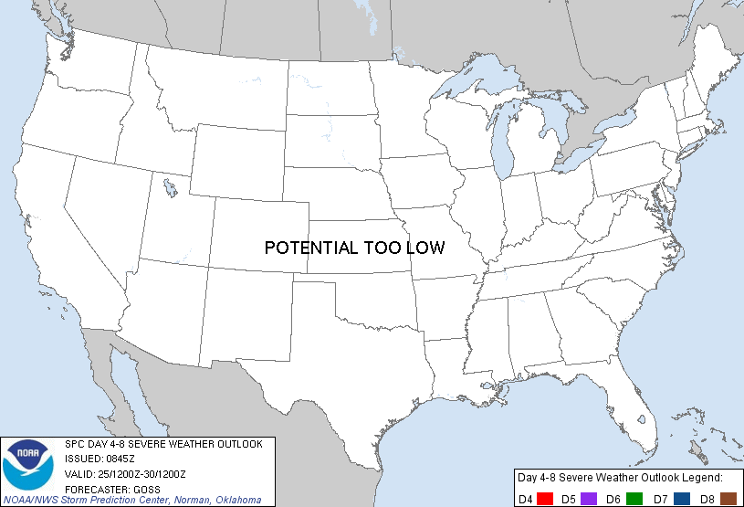
POTENTIAL TOO LOW means the threat for a regional area of organized severe storms appears highly unlikely during the entire period (e.g. less than a 30% probability for a regional severe storm area across the CONUS through the entire Day 4-8 period).
Forecast Discussion
   ZCZC SPCSWOD48 ALL
   ACUS48 KWNS 220845
   SPC AC 220845

   DAY 4-8 CONVECTIVE OUTLOOK
   NWS STORM PREDICTION CENTER NORMAN OK
   0345 AM CDT FRI MAR 22 2013

   VALID 251200Z - 301200Z

   ...DISCUSSION...
   AS ERN U.S. TROUGHING SLOWLY SHIFTS EWD AND A RIDGE MOVES INTO THE
   CENTRAL STATES DURING THE FIRST HALF OF THE PERIOD...SLOW
   DEAMPLIFICATION OF THE FLOW FIELD OVER THE U.S. IS ALSO EXPECTED TO
   OCCUR.  WITH SURFACE HIGH PRESSURE SHIFTING SEWD INTO THE SOUTHEAST
   STATES IN THE WAKE OF THE UPPER TROUGH...A COLD FRONT AT THE LEADING
   EDGE OF THE COOLER CONTINENTAL AIRMASS WILL BE SHOVED SWD THROUGH
   THE ENTIRE GULF OF MEXICO PER BOTH THE GFS AND ECMWF -- THUS
   PRECLUDING ACTIVE CONVECTIVE THREAT E OF THE ROCKIES THROUGH AT
   LEAST DAY 6-7.

   LATE IN THE PERIOD...A SRN STREAM TROUGH IS PROGGED TO APPROACH --
   OR REACH -- SRN CA.  THIS SYSTEM WOULD ATTM APPEAR TO REPRESENT THE
   NEXT CHANCE FOR RETURN OF A HIGHER THETA-E AIRMASS INTO THE CENTRAL
   AND ERN U.S. -- AND ASSOCIATED CONVECTIVE POTENTIAL.  HOWEVER...WITH
   THIS GULF MOISTURE RETURN NOT ANTICIPATED UNTIL AFTER THE END OF THE
   PERIOD...LITTLE POTENTIAL FOR ORGANIZED SEVERE WEATHER THROUGH DAY 8
   PRECLUDES ISSUANCE OF ANY OUTLOOK AREAS THIS FORECAST.

   ..GOSS.. 03/22/2013

   CLICK TO GET WUUS48 PTSD48 PRODUCT


 @NWSSPC