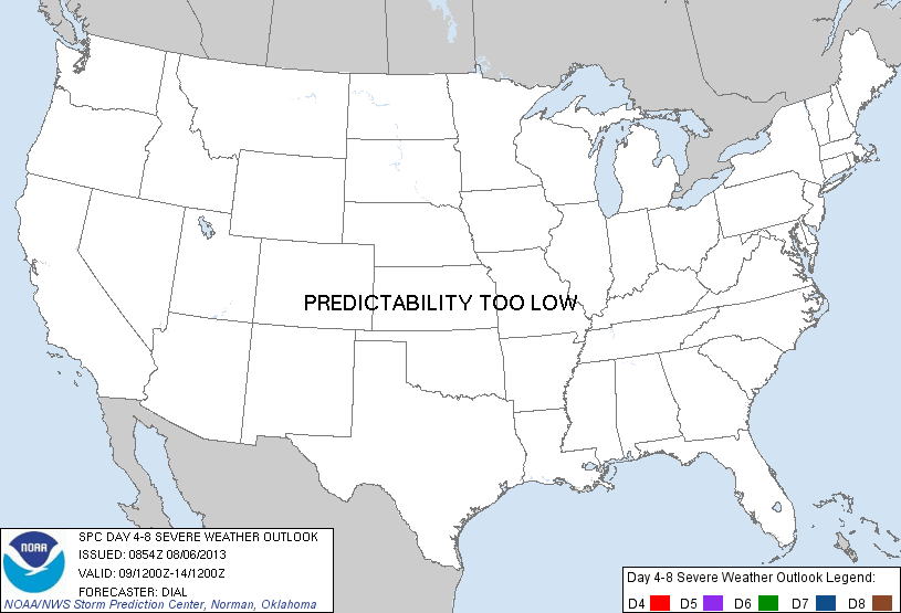
Day 4-8 Severe Weather Outlook Issued on Aug 6, 2013
Updated: Tue Aug 6 08:55:04 UTC 2013
Risk
Area (sq. mi.)
Area Pop.
Some Larger Population Centers in Risk Area
No Risk Areas Forecast
D4
Fri, Aug 09, 2013 - Sat, Aug 10, 2013
D7
Mon, Aug 12, 2013 - Tue, Aug 13, 2013
D5
Sat, Aug 10, 2013 - Sun, Aug 11, 2013
D8
Tue, Aug 13, 2013 - Wed, Aug 14, 2013
D6
Sun, Aug 11, 2013 - Mon, Aug 12, 2013
(All days are valid from 12 UTC - 12 UTC the following day)
Note: A severe weather area depicted in the Day 4-8 period indicates a 30% or higher probability for severe thunderstorms within 25 miles of any point.
PREDICTABILITY TOO LOW is used to indicate severe storms may be possible based on some model scenarios. However, the location or occurrence of severe storms are in doubt due to: 1) large differences in the deterministic model solutions, 2) large spread in the ensemble guidance, and/or 3) minimal run-to-run continuity.
POTENTIAL TOO LOW means the threat for a regional area of organized severe storms appears highly unlikely during the entire period (e.g. less than a 30% probability for a regional severe storm area across the CONUS through the entire Day 4-8 period).
Forecast Discussion
   ZCZC SPCSWOD48 ALL
   ACUS48 KWNS 060854
   SPC AC 060854

   DAY 4-8 CONVECTIVE OUTLOOK
   NWS STORM PREDICTION CENTER NORMAN OK
   0354 AM CDT TUE AUG 06 2013

   VALID 091200Z - 141200Z

   ...DISCUSSION...
   MODEL CONSENSUS INCLUDING DETERMINISTIC AND ENSEMBLE ECMWF AND GFS
   INDICATE THE SYNOPTIC PATTERN WILL BE CHARACTERIZED BY A MEAN UPPER
   TROUGH OVER THE ERN U.S. WITH UPPER RIDGE AXIS FARTHER WEST FROM THE
   SRN THROUGH NRN ROCKIES. A FRONT INITIALLY FROM THE OH VALLEY INTO
   THE NERN STATES WILL ADVANCE PROGRESSIVELY SWD...EVENTUALLY REACHING
   THE SERN U.S. DAY 5...WHILE WRN PORTION LIFTS NWD AS A WARM FRONT
   THROUGH THE PLAINS. STORMS WILL LIKELY DEVELOP ALONG AND SOUTH OF
   THIS BOUNDARY FROM SRN PARTS OF THE OH VALLEY INTO THE SERN STATES
   EARLY IN 4-8 PERIOD...BUT WARM SECTOR WILL HAVE BEEN SHIFTED SOUTH
   OF STRONGER WINDS ALOFT.

   FARTHER WEST...SOMEWHAT RICHER MOISTURE WILL BEGIN RETURNING NWWD
   THROUGH THE CNTRL AND NRN HIGH PLAINS BY DAY 5-6...AND POTENTIAL
   WILL EXIST FOR STORMS TO DEVELOP OVER THE HIGHER TERRAIN AND SPREAD
   EWD INTO THE PLAINS. OTHER STORMS MAY DEVELOP IN WARM ADVECTION ZONE
   NORTH OF WARM FRONT. MUCH OF THIS REGION WILL EXIST BENEATH AN UPPER
   RIDGE AXIS...AND A MORE ROBUST SEVERE THREAT WILL PROBABLY DEPEND ON
   TIMING OF SMALLER SCALE IMPULSES MOVING THROUGH THE RIDGE.
   THEREFORE...CONFIDENCE IS NOT SUFFICIENT AT THIS TIME TO INTRODUCE
   AN ENHANCED SEVERE PROBABILITY AREA.

   ..DIAL.. 08/06/2013

   CLICK TO GET WUUS48 PTSD48 PRODUCT


 @NWSSPC