|
| Mesoscale Discussion 2102 |
|
< Previous MD
Next MD >
|
|
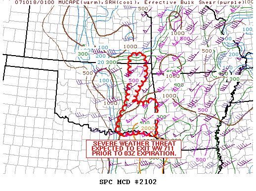
   MESOSCALE DISCUSSION 2102
   NWS STORM PREDICTION CENTER NORMAN OK
   0838 PM CDT WED OCT 17 2007

   AREAS AFFECTED...PARTS OF ERN OK

   CONCERNING...TORNADO WATCH 711...

   VALID 180138Z - 180245Z

   THE SEVERE WEATHER THREAT FOR TORNADO WATCH 711 CONTINUES.

   REGIONAL RADARS SHOWED A LINE OF STRONG TO SEVERE TSTMS EXTENDING
   FROM NERN INTO EAST CENTRAL OK.  PARAMETERS REMAIN FAVORABLE FOR
   DAMAGING WINDS AND ISOLATED TORNADOES AS ACTIVITY TRACKS TO THE
   NE...WITH CURRENT TRENDS SUGGESTING THE SEVERE WEATHER THREAT SHOULD
   EXIT WW 711 PRIOR TO THE 03Z EXPIRATION.  THUS...WW COULD BE
   CANCELLED EARLY.

   ..PETERS.. 10/18/2007


   ATTN...WFO...SGF...SHV...TSA...ICT...FWD...OUN...

   33699452 33939524 33779648 33789647 34249645 35259597
   36169579 37039583 37399576 37399508 36449499 35729553
   35239571 35089513 35389443
|
|
Top/All Mesoscale Discussions/Forecast Products/Home
|
|


 @NWSSPC