|
| Mesoscale Discussion 1705 |
|
< Previous MD Next MD >
|

|
   MESOSCALE DISCUSSION 1705
   NWS STORM PREDICTION CENTER NORMAN OK
   1128 PM CDT TUE SEP 09 2014

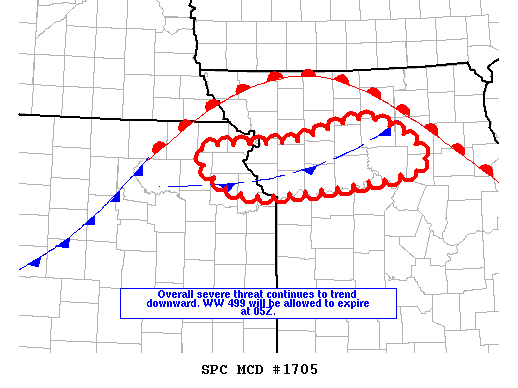
   AREAS AFFECTED...NRN KS THROUGH NRN MO

   CONCERNING...TORNADO WATCH 499...

   VALID 100428Z - 100500Z

   THE SEVERE WEATHER THREAT FOR TORNADO WATCH 499 CONTINUES.

   SUMMARY...SEVERE THREAT SHOULD CONTINUE TO DECREASE. UNLESS
   CONVECTIVE TRENDS DICTATE OTHERWISE...TORNADO WATCH 499 WILL BE
   ALLOWED TO EXPIRE AT 05Z AND ANOTHER WW IS NOT ANTICIPATED.

   DISCUSSION...STORMS WITH MARGINAL HP SUPERCELL STRUCTURES CONTINUE
   OVER NRN MO AND APPEAR ELEVATED NORTH OF A CONVECTIVELY MODIFIED
   BOUNDARY. OTHERWISE...STORMS HAVE MERGED INTO E-W BANDS AND CLUSTERS
   FROM NRN KS THROUGH NRN MO AND HAVE BECOME LESS ORGANIZED...POSING
   MAINLY A HEAVY RAIN THREAT. WHILE ISOLATED INSTANCES OF STRONG TO
   DAMAGING WIND GUSTS CANNOT BE RULED OUT NEXT FEW HOURS...OVERALL
   SEVERE THREAT APPEARS TOO MARGINAL TO WARRANT ANOTHER WW ISSUANCE.

   ..DIAL.. 09/10/2014


   ATTN...WFO...EAX...TOP...

   LAT...LON   39689571 39779440 40029319 39449252 39179499 39689571
|
|
Top/All Mesoscale Discussions/Forecast Products/Home
|
|


