|
| Mesoscale Discussion 44 |
|
< Previous MD Next MD >
|
|
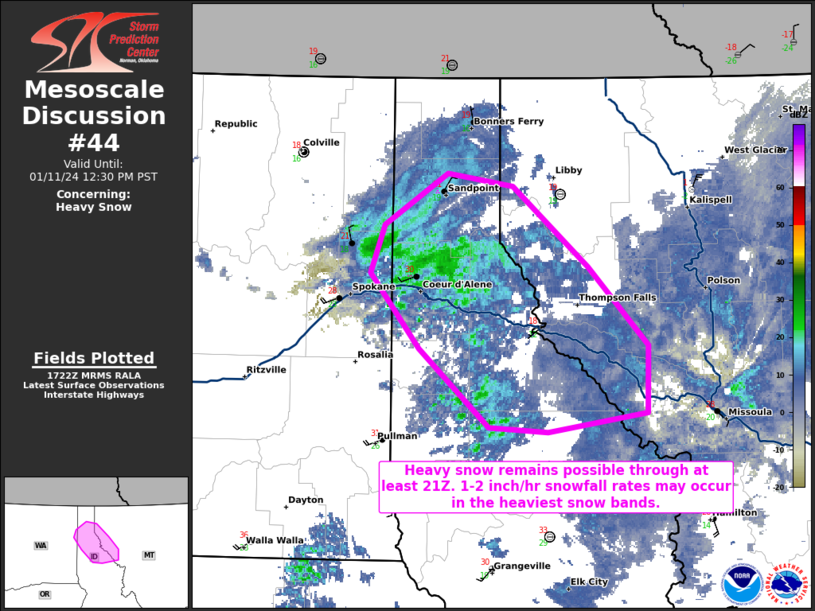
   Mesoscale Discussion 0044
   NWS Storm Prediction Center Norman OK
   1125 AM CST Thu Jan 11 2024

   Areas affected...portions of northern Idaho into extreme western
   Montana

   Concerning...Heavy snow

   Valid 111725Z - 112030Z

   SUMMARY...Heavy snow should continue for at least a few more hours,
   with 1-2 inch/hr snowfall rates common. Reduced visibility is likely
   in the heavier snow bands.

   DISCUSSION...A low-level cyclone is drifting southeast across the
   Idaho Panhandle into extreme western Montana as a mid-level impulse
   traverses the International border, providing deep-layer ascent.
   Latest mesoanalysis and RAP forecast soundings characterize vertical
   profiles as near saturated, with deep-layer steep lapse rates,
   supporting a sufficiently deep and moist dendritic growth zone to
   support continued 1-2 inch/hr snowfall rates given strong lift in
   place. Latest high-resolution guidance suggests that at least brief
   bouts of heavy snow and perhaps reduced visibility should continue
   through at least 21Z.

   ..Squitieri.. 01/11/2024

   ...Please see www.spc.noaa.gov for graphic product...

   ATTN...WFO...MSO...OTX...

   LAT...LON   46821614 47311678 47791724 48091710 48401652 48321593
               47821523 47331468 46911470 46791560 46821614
|
|
Top/All Mesoscale Discussions/Forecast Products/Home
|
|


 @NWSSPC