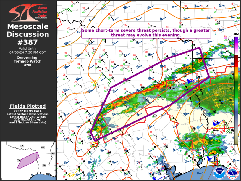
   Mesoscale Discussion 0387
   NWS Storm Prediction Center Norman OK
   0555 PM CDT Mon Apr 08 2024

   Areas affected...Parts of central/northeast TX into extreme
   northwest LA/southwest AR

   Concerning...Tornado Watch 90...

   Valid 082255Z - 090030Z

   The severe weather threat for Tornado Watch 90 continues.

   SUMMARY...The short-term severe threat remains uncertain, but a
   couple stronger supercells and/or storm clusters could evolve with
   time this evening, with all severe hazards possible.

   DISCUSSION...Convection has continued to spread northward from
   central into northeast TX, along the northern periphery of deeper
   returning low-level moisture. Despite MLCAPE in excess of 1500 J/kg
   and favorable deep-layer shear, convection has struggled to remain
   organized thus far, possibly due to a lack of stronger low-level
   flow and the impacts of northward-moving outflow. However, some
   short-term threat for hail and gusty winds may move north of WW 90
   early this evening.

   As the low-level jet strengthens a little later this evening,
   ongoing convection may become more organized, with potential for a
   stronger supercell or two and/or an upscale growing cluster to
   develop with time. Should this occur, some increase in the tornado
   threat would be possible, in addition to an ongoing threat for hail
   and localized damaging gusts.

   Depending on short-term convective trends, WW 90 may need to be
   expanded to the north and west to cover the severe threat.
   Otherwise, there is some potential for additional watch issuance
   across parts of central/northeast TX later this evening, depending
   on the evolution of both ongoing convection and potential storm
   development to the west.

   ..Dean/Hart.. 04/08/2024

   ...Please see www.spc.noaa.gov for graphic product...

   ATTN...WFO...SHV...HGX...FWD...EWX...

   LAT...LON   30779765 32139697 33039492 33359377 32449346 31629486
               30519749 30779765
|


 @NWSSPC