|
| Mesoscale Discussion 423 |
|
< Previous MD Next MD >
|
|
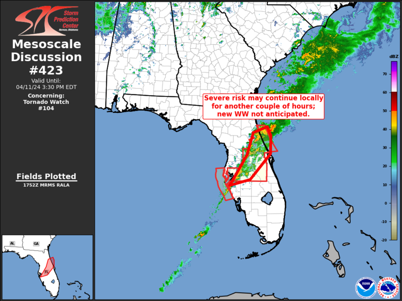
   Mesoscale Discussion 0423
   NWS Storm Prediction Center Norman OK
   1254 PM CDT Thu Apr 11 2024

   Areas affected...central Florida

   Concerning...Tornado Watch 104...

   Valid 111754Z - 111930Z

   The severe weather threat for Tornado Watch 104 continues.

   SUMMARY...Potential for gusty winds and a brief tornado may continue
   locally over the next couple of hours, but new WW issuance is not
   anticipated.  Local WW extensions may be needed for a short time, to
   cover any lingering threat beyond the scheduled 11/19Z expiration of
   WW 104.

   DISCUSSION...Strong storms continue crossing central portions of the
   Florida Peninsula at this time, within a band extending from north
   of Daytona Beach to near Sarasota.  Storms have shown an overall,
   gradual decrease in organization, in part likely due to low-level
   veering of the winds ahead of the band.  With little in the way of
   additional destabilization anticipated ahead of the convection,
   steady or gradually decreasing severe-weather potential seems
   likely.  Still, a locally stronger storm or two will remain capable
   of producing a damaging gust or brief tornado this afternoon.

   ..Goss.. 04/11/2024

   ...Please see www.spc.noaa.gov for graphic product...

   ATTN...WFO...MLB...TBW...JAX...

   LAT...LON   27478254 28708176 29618148 29848082 29488066 28758069
               27708162 27478254
|
|
Top/All Mesoscale Discussions/Forecast Products/Home
|
|


 @NWSSPC