The SPC is forecasting ...severe thunderstorms with widespread damaging winds and a few tornadoes expected over parts of the mid atlantic states into portions of southern new york this afternoon into tonight.... Please read the latest public statement about this event. View What is a Watch? clip.
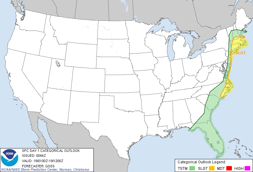
| Categorical Graphic |
|---|
|
| Probabilistic Tornado Graphic |
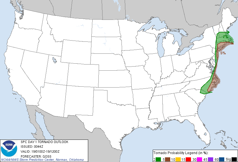 |
| Probability of a tornado within 25 miles of a point. Hatched Area: 10% or greater probability of EF2 - EF5 tornadoes within 25 miles of a point. |
| Probabilistic Damaging Wind Graphic |
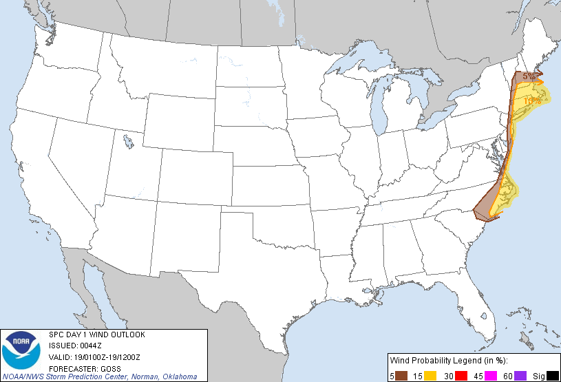 |
| Probability of damaging thunderstorm winds or wind gusts of 50 knots or higher within 25 miles of a point. Hatched Area: 10% of greater probability of wind gusts 65 knots or greater within 25 miles of a point. |
| Probabilistic Large Hail Graphic |
 |
| Probability of hail 1" or larger within 25 miles of a point. Hatched Area: 10% or greater probability of hail 2" or larger within 25 miles of a point. |
   SPC AC 190044

   DAY 1 CONVECTIVE OUTLOOK
   NWS STORM PREDICTION CENTER NORMAN OK
   0744 PM CDT TUE SEP 18 2012

   VALID 190100Z - 191200Z

   ...THERE IS A SLGT RISK OF SVR TSTMS FROM SRN NEW ENGLAND SSWWD TO
   ERN NC...

   ...SRN NEW ENGLAND SWD TO THE NC COASTAL PLAIN...
   BAND OF CONVECTION EXTENDING FROM WRN NEW ENGLAND SSWWD INTO GA WILL
   CONTINUE SHIFTING EWD THIS EVENING...AHEAD OF AN ADVANCING COLD
   FRONT.  WHILE INSTABILITY WILL REMAIN MEAGER AT BEST FROM THE
   MID-ATLANTIC REGION NWD...VERY STRONG/VEERING FLOW WITH HEIGHT
   WARRANTS CONTINUATION OF WIND/ISOLATED TORNADO PROBABILITY ACROSS
   THIS REGION.

   MEANWHILE...GREATER INSTABILITY EXISTS FROM ERN NC SSWWD...BUT
   VEERING/SHEAR DECREASES WITH SWD EXTENT -- AND THUS WILL EXTEND
   SLIGHT RISK NO FARTHER S THAN SERN NC.

   THREAT SHOULD SHIFT OFFSHORE FROM THE MID-ATLANTIC REGION SWD OVER
   THE NEXT COUPLE OF HOURS...BUT MAY LINGER ACROSS SRN NEW ENGLAND
   WELL INTO THE OVERNIGHT HOURS.

   ..GOSS.. 09/19/2012

   CLICK TO GET WUUS01 PTSDY1 PRODUCT

   NOTE: THE NEXT DAY 1 OUTLOOK IS SCHEDULED BY 0600Z