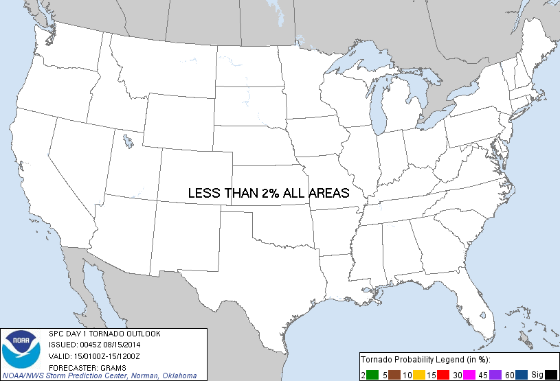
Probability of a tornado within 25 miles of a point. Hatched Area: 10% or greater probability of EF2 - EF5 tornadoes within 25 miles of a point.
Tornado Risk
Area (sq. mi.)
Area Pop.
Some Larger Population Centers in Risk Area
No Risk Areas Forecast
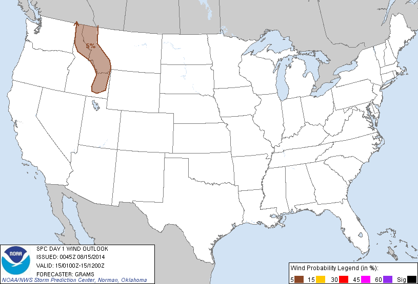
Probabilistic Damaging Wind Graphic
Probability of damaging thunderstorm winds or wind gusts of 50 knots or higher within 25 miles of a point. Hatched Area: 10% of greater probability of wind gusts 65 knots or greater within 25 miles of a point.
Wind Risk
Area (sq. mi.)
Area Pop.
Some Larger Population Centers in Risk Area
5 %
60,708
906,150
Missoula, MT...Idaho Falls, ID...Pocatello, ID...Butte, MT...Rexburg, ID...
Probabilistic Large Hail Graphic
Probability of hail 1" or larger within 25 miles of a point. Hatched Area: 10% or greater probability of hail 2" or larger within 25 miles of a point.
Hail Risk
Area (sq. mi.)
Area Pop.
Some Larger Population Centers in Risk Area
5 %
62,324
925,324
Missoula, MT...Idaho Falls, ID...Pocatello, ID...Butte, MT...Rexburg, ID...
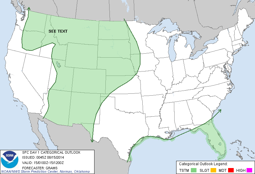
   SPC AC 150045

   DAY 1 CONVECTIVE OUTLOOK
   NWS STORM PREDICTION CENTER NORMAN OK
   0745 PM CDT THU AUG 14 2014

   VALID 150100Z - 151200Z

   ...NO SVR TSTM AREAS FORECAST...

   ...SUMMARY...
   MARGINALLY SEVERE HAIL AND WIND MAY OCCUR WITHIN A COUPLE OF STORMS
   ACROSS PARTS OF NORTHERN/EASTERN IDAHO AND WESTERN MONTANA THIS
   EVENING.

   ...NRN/ERN ID...WRN MT...
   AN IMPULSE EMBEDDED WITHIN THE BROADER UPPER CYCLONE OVER THE
   PACIFIC NW IN CONJUNCTION WITH DIURNALLY-DRIVEN OROGRAPHIC ASCENT
   HAS CONTRIBUTED TO SCATTERED CONVECTION ARCING FROM THE ID PANHANDLE
   INTO WRN MT AND SERN ID. AMIDST MODERATE MID/UPPER-LEVEL SPEED SHEAR
   PER 00Z OTX/TFX/BOI RAOBS...A RISK FOR MARGINALLY SEVERE HAIL AND
   STRONG WIND GUSTS SHOULD EXIST DESPITE WEAK BUOYANCY. STORMS SHOULD
   DIMINISH IN INTENSITY AFTER SUNSET.

   ..GRAMS.. 08/15/2014

   CLICK TO GET WUUS01 PTSDY1 PRODUCT

   NOTE: THE NEXT DAY 1 OUTLOOK IS SCHEDULED BY 0600Z