SPC AC 101947
Day 1 Convective Outlook
NWS Storm Prediction Center Norman OK
0147 PM CST Fri Mar 10 2017
Valid 102000Z - 111200Z
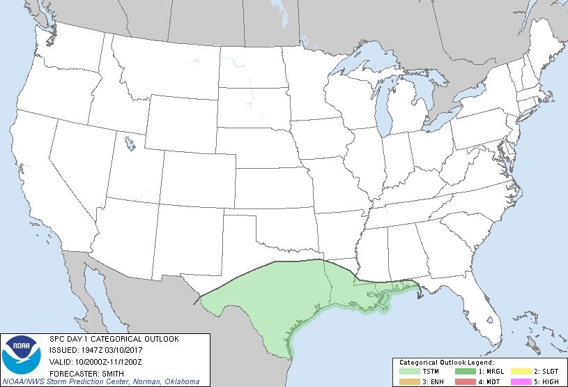
...NO SEVERE THUNDERSTORM AREAS FORECAST...
...SUMMARY...
Isolated to scattered thunderstorms will be possible today from
Texas eastward to the southeast United States. However, organized
severe weather is not expected.
No appreciable change was made to the previous forecast.
..Smith.. 03/10/2017
.PREV DISCUSSION... /ISSUED 1015 AM CST Fri Mar 10 2017/
...Synopsis...
A western U.S. ridge/eastern U.S. trough pattern aloft will prevail
over the CONUS today, though some deamplification of the flow field
is expected as short-wave troughing -- rotating around the southern
side of an eastern Canada vortex -- shifts across the eastern states
through the first half of the period.
As this short-wave trough advances cyclonically eastward, an
associated surface cold front -- trailing from a
northeastward-moving low over the western Atlantic -- will continue
to shift eastward away from the Atlantic coast, and southward across
the Gulf coastal region and the northern Gulf of Mexico. Farther
west, this front should become quasi-stationary and aligned
west-to-east across central Texas through the end of the period.
...Southern Plains eastward into the Southeast...
With convection now largely off the southeast U.S. Atlantic Coast,
thunder risk has largely ended. One exception may be across parts
of northeast Florida, where a few showers or an afternoon
thunderstorm cannot be ruled out.
Farther west, convection continues shifting southward toward/off the
central Gulf coastal areas, though a few thunderstorms persist
across parts of southern Mississippi/Louisiana. More widespread
storms are ongoing from south Texas east into the western Gulf, and
an increase in thunderstorms across Texas is expected today as the
cold front drifts southward and eventually stalls. Despite ample
CAPE, very weak flow aloft should hinder potential for updraft
organization, and thus any severe risk would likely be
brief/marginal with a stronger pulse-type storm.
Finally, low-level warm advection is forecast to increase tonight
across the southern Plains and vicinity, north of the aforementioned
surface front. However, meager instability currently anticipated
suggests no more than a very isolated lightning strikes within
showery/elevated convection -- likely remaining insufficient to
warrant continuation of a 10% thunder area north of the Red River.
CLICK TO GET WUUS01 PTSDY1 PRODUCT
NOTE: THE NEXT DAY 1 OUTLOOK IS SCHEDULED BY 0100Z
|