Probability of a tornado within 25 miles of a point. Hatched Area: 10% or greater probability of EF2 - EF5 tornadoes within 25 miles of a point.
Day 1 Tornado Risk
Area (sq. mi.)
Area Pop.
Some Larger Population Centers in Risk Area
No Risk Areas Forecast
Probabilistic Damaging Wind Graphic
Probability of damaging thunderstorm winds or wind gusts of 50 knots or higher within 25 miles of a point. Hatched Area: 10% of greater probability of wind gusts 65 knots or greater within 25 miles of a point.
SPC AC 071946
Day 1 Convective Outlook
NWS Storm Prediction Center Norman OK
0246 PM CDT Fri Apr 07 2017
Valid 072000Z - 081200Z
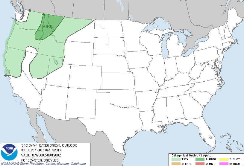
...THERE IS A MARGINAL RISK OF SEVERE THUNDERSTORMS ACROSS NORTHERN
PARTS OF THE INTERMOUNTAIN WEST...
...SUMMARY...
A few thunderstorms associated with hail and strong wind gusts will
be possible across northeast Oregon, extreme eastern Washington,
northern Idaho, and northwest Montana through this evening.
No changes are made to the outlook for this issuance.
..Broyles.. 04/07/2017
.PREV DISCUSSION... /ISSUED 1117 AM CDT Fri Apr 07 2017/
...Synopsis...
A high-amplitude flow pattern is forecast to progress slowly
eastward across the CONUS during the period as a long-wave trough
approaches the Pacific coast tonight.
Within the larger-scale western trough, water vapor imagery shows a
series of features that will impact convective potential over the
northwest US. First, a short-wave trough is moving rapidly
northeastward across the northern intermountain region, downstream
from an upper low off the Pacific Northwest coast near 45.9N/126.7W
that is lifting toward southern British Columbia. An upstream
trough over the eastern Pacific is moving eastward and will approach
the northern California coast late tonight.
...Northern Intermountain/Northern Rockies Region...
Ongoing low-topped thunderstorms are associated with the
aforementioned lead short-wave trough moving across the area. This
activity is expected to continue spreading toward northwest Montana
into the afternoon. Additional storms are expected to develop in
the wake of the initial convection from parts of northeast Oregon
and northern Idaho into northwest Montana, where visible satellite
imagery indicates some breaks in the cloud cover developing. This
will promote zones of stronger diabatic heating to occur, and when
coupled with cooling temperatures aloft, will contribute to
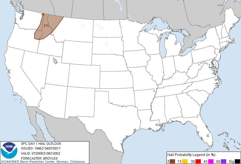
steepening surface-500 mb lapse rates of 7.5-8.0 C/km. Although
moisture will be limited with PW values of 0.5-0.75 in, MUCAPE will
reach 250-400 J/kg in areas where stronger heating occurs.
Dynamic forcing for large-scale ascent associated with the left exit
region of a strong southwesterly upper-level jet will overspread the
region from southwest to northeast into this evening. Sufficient
vertical shear /35-45 kt effective bulk shear/ coupled with steep
lapse rates suggest potential for stronger cells to produce
marginally severe hail. In addition, drier boundary layer profiles
will enhance downdraft intensity through evaporative cooling
processes, which may promote a few strong surface wind gusts through
this evening.
CLICK TO GET WUUS01 PTSDY1 PRODUCT
NOTE: THE NEXT DAY 1 OUTLOOK IS SCHEDULED BY 0100Z