Probability of damaging thunderstorm winds or wind gusts of 50 knots or higher within 25 miles of a point. Hatched Area: 10% of greater probability of wind gusts 65 knots or greater within 25 miles of a point.
SPC AC 241247
Day 1 Convective Outlook
NWS Storm Prediction Center Norman OK
0747 AM CDT Mon Apr 24 2017
Valid 241300Z - 251200Z
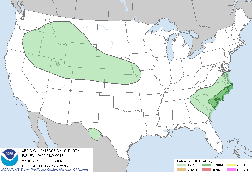
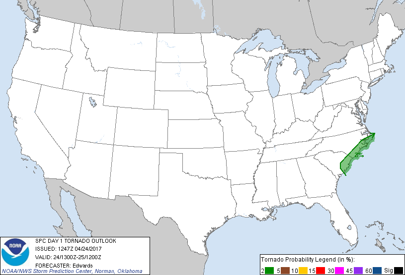
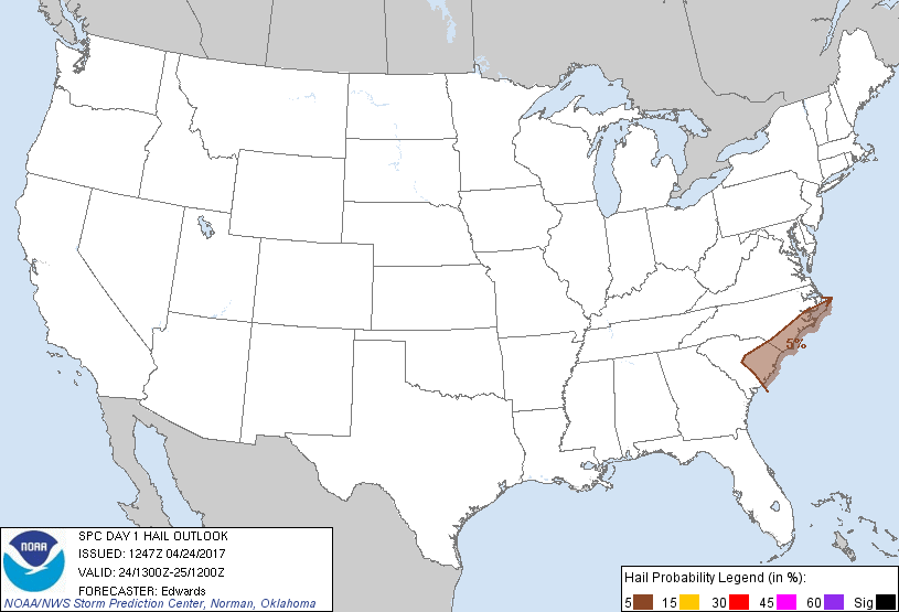
...THERE IS A MARGINAL RISK OF SEVERE THUNDERSTORMS OVER PARTS OF
THE EASTERN CAROLINAS....
...SUMMARY...
Thunderstorms will offer marginal severe-weather risk over parts of
the eastern Carolinas.
...Synopsis...
The most important upper-air feature for severe-storm potential will
be a mid/upper-level cyclone, now apparent in moisture-channel
imagery over much of AL and GA. The associated 500-mb low,
initially near CSG, should track in a cyclonically curved arc near
MCN, SAV, CHS and MYR through the period. As this occurs, the
related surface low -- analyzed at 11Z between CHS and NBC -- should
migrate slowly northeastward across the SC coastal plain today.
Overnight, this low effectively should merge with an initially
separate, north-northwestward-moving surface cyclone now over
Atlantic waters north of the northern Bahamas. The combined low is
expected to move inland over eastern NC by 12Z. A cold front,
initially extending south-southwestward over northern FL and the
eastern Gulf, will shift eastward across SC south of the low, and
eastward over the FL Peninsula, through the period. A sharply
defined warm front, initially from the low northeastward over NC
coastal waters, is expected to move slowly northward/inland through
the period. The timing and inland extent of the front's progress
likely will be impeded more than most model progs indicate, by
rain/outflow reinforcement of boundary-layer static stability on its
poleward side.
Meanwhile, a series of mostly low-amplitude, mid/upper-level
shortwave perturbations will traverse and reinforce a large-scale
trough, and related cyclonic flow covering much of the western and
central U.S. Associated cooling aloft, steep lapse rates and
marginal low-level moisture, as well as low-level warm advection
tonight in the central Plains, should contribute to a broad swath of
potential for isolated to widely scattered thunderstorms from the
northern Great Basin and northern Rockies across the central Plains.
...Carolinas...
As the cold-core region of the mid/upper cyclone approaches, pockets
of surface heating occur in cloud breaks, and lapse rates steepen
atop available low-level moisture, a few bands or arcs of
thunderstorms are expected to develop episodically and move east-
northeastward across the outlook area. Activity in the warm sector
will access pockets of high-theta-e marine air as well as impinge
upon the warm-frontal zone, while offering isolated hail near severe
limits, damaging gusts and a conditional/marginal tornado risk. The
hail risk may extend somewhat poleward of the warm front with
elevated convection. Minor coastward adjustments to the marginal-
severe probabilities (especially wind) are made over SC to account
for a slightly less-inland expected penetration of favorable
surface- and near-surface-based effective-inflow parcels, based on
the expected track of the surface low.
Forecast soundings and the modified 12Z CHS RAOB suggest up to about
1500 J/kg warm-sector MLCAPE may develop, decreasing quickly along
and north of the warm front and under persistent convective cloud/
precip plumes. Deep shear will remain modest, with a substantial
component of the mean flow parallel to the convergence zone(s)
providing convective-scale forcing. This should contribute to a
dominant linear mode, with isolated bow/lewp formations and
ephemeral QLCS mesovortices embedded -- particularly near the warm
front where low-level vorticity, SRH and storm-relative flow all
will be relatively maximized.
..Edwards/Peters.. 04/24/2017
CLICK TO GET WUUS01 PTSDY1 PRODUCT
NOTE: THE NEXT DAY 1 OUTLOOK IS SCHEDULED BY 1630Z