Probability of a tornado within 25 miles of a point. Hatched Area: 10% or greater probability of EF2 - EF5 tornadoes within 25 miles of a point.
Day 1 Tornado Risk
Area (sq. mi.)
Area Pop.
Some Larger Population Centers in Risk Area
No Risk Areas Forecast
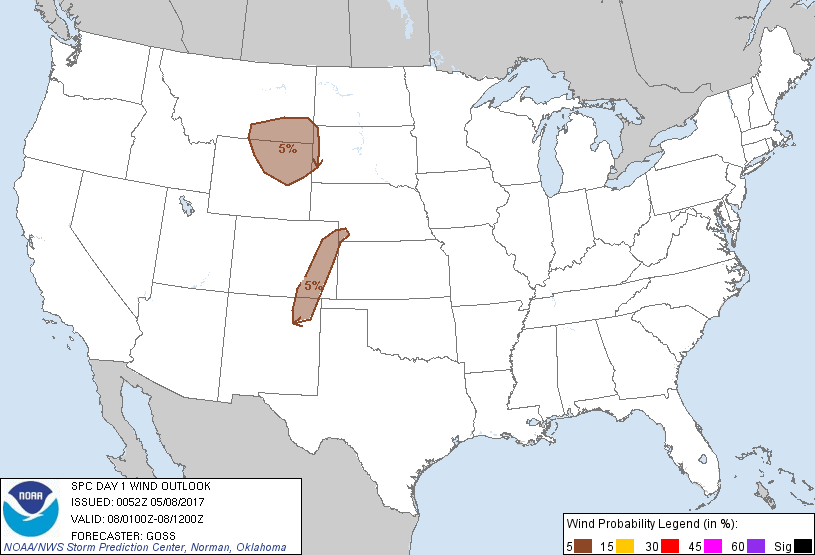
Probabilistic Damaging Wind Graphic
Probability of damaging thunderstorm winds or wind gusts of 50 knots or higher within 25 miles of a point. Hatched Area: 10% of greater probability of wind gusts 65 knots or greater within 25 miles of a point.
SPC AC 080052
Day 1 Convective Outlook
NWS Storm Prediction Center Norman OK
0752 PM CDT Sun May 07 2017
Valid 080100Z - 081200Z
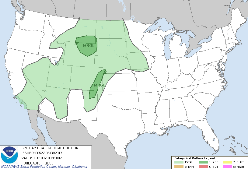
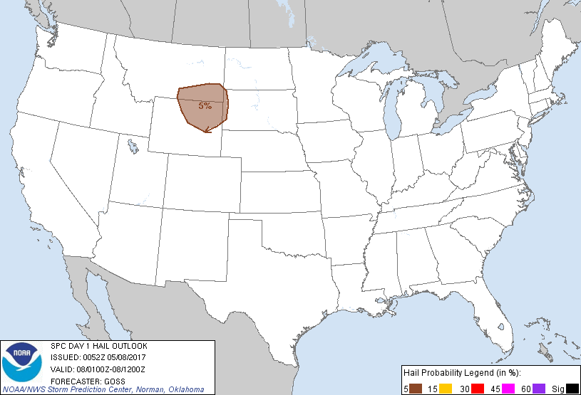
...THERE IS A MARGINAL RISK OF SEVERE THUNDERSTORMS ACROSS SOUTHEAST
MONTANA AND NORTHEAST WYOMING AND NEARBY AREAS...
...THERE IS A MARGINAL RISK OF SEVERE THUNDERSTORMS FROM NORTHEAST
NEW MEXICO NORTH-NORTHEAST ACROSS EASTERN COLORADO INTO SOUTHWEST
NEBRASKA...
...SUMMARY...
Risk for isolated strong storms capable of marginally severe hail
and wind will continue for a few more hours across the northeast
Wyoming/southeast Montana vicinity this afternoon and evening.
Isolated damaging gusts will also remain possible for a couple more
hours with a couple of the stronger cells over parts of the High
Plains.
...Southeast Montana/northeast Wyoming and adjacent western South
Dakota...
A very loosely organized north-northwest to south-southeast band of
showers and scattered thunderstorms continues shifting east across
south-central Montana and the northeast half of Wyoming at this
time. More isolated cells are occurring as far east as the Black
Hills, all within broadly cyclonic/diffluent flow surrounding the
southern California upper low. Storms should gradually decrease in
intensity over the next several hours as the boundary layer cools.
However, potential for strong/gusty winds and possibly a marginally
severe hailstone or two may linger into the mid- to late-evening
hours.
...Northeast New Mexico and eastern Colorado into far southwest
Nebraska...
Showers and scattered thunderstorms continue to spread/develop
eastward across eastern Colorado and portions of southwest Nebraska
early this evening, along and ahead of ill-defined outflow. Other
storms are moving northward across northeast New Mexico. While
evening soundings suggest rather rapid airmass stabilization will
occur as the boundary layer cools into the evening hours, locally
gusty winds will remain possible with stronger cells for perhaps the
next 1-3 hours.
..Goss.. 05/08/2017
CLICK TO GET WUUS01 PTSDY1 PRODUCT
NOTE: THE NEXT DAY 1 OUTLOOK IS SCHEDULED BY 0600Z