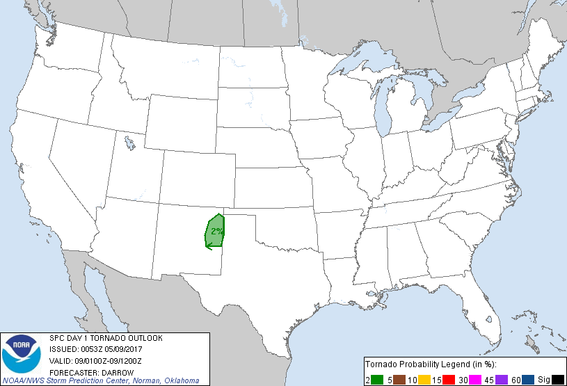
Denver, CO...Colorado Springs, CO...Aurora, CO...Lakewood, CO...Thornton, CO...
Probabilistic Tornado Graphic
Probability of a tornado within 25 miles of a point. Hatched Area: 10% or greater probability of EF2 - EF5 tornadoes within 25 miles of a point.
Day 1 Tornado Risk
Area (sq. mi.)
Area Pop.
Some Larger Population Centers in Risk Area
2 %
12,679
79,468
Clovis, NM...Portales, NM...Tucumcari, NM...
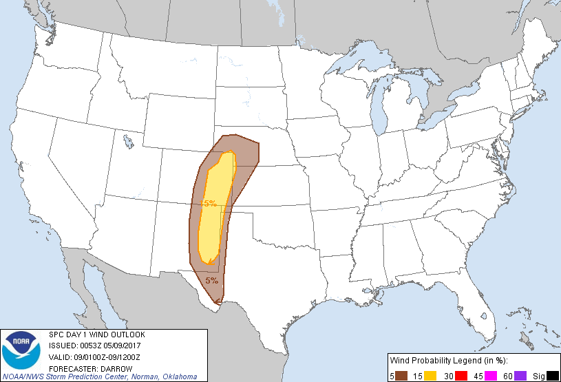
Probabilistic Damaging Wind Graphic
Probability of damaging thunderstorm winds or wind gusts of 50 knots or higher within 25 miles of a point. Hatched Area: 10% of greater probability of wind gusts 65 knots or greater within 25 miles of a point.
Denver, CO...Colorado Springs, CO...Aurora, CO...Lakewood, CO...Thornton, CO...
SPC AC 090053
Day 1 Convective Outlook
NWS Storm Prediction Center Norman OK
0753 PM CDT Mon May 08 2017
Valid 090100Z - 091200Z
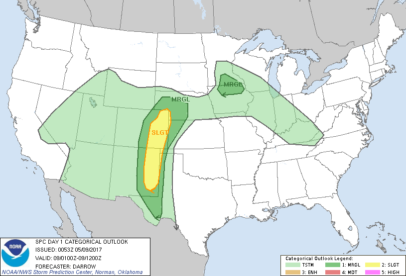
...THERE IS A SLIGHT RISK OF SEVERE THUNDERSTORMS ACROSS THE HIGH
PLAINS OF CO/NM...
...THERE IS A MARGINAL RISK OF SEVERE THUNDERSTORMS FROM FAR WEST TX
TO WESTERN NE...
...THERE IS A MARGINAL RISK OF SEVERE THUNDERSTORMS OVER PORTIONS OF
SOUTHERN MN AND NORTHERN IA...
...SUMMARY...
Isolated to scattered severe thunderstorms will continue this
evening across eastern New Mexico and eastern Colorado.
...High Plains...
Widespread convection developed over the higher terrain of the
central/southern Rockies this afternoon and is now primarily
concentrated along a corridor from the high plains of NM into
northeast CO. Considerable amount of buoyancy remains along the
eastern fringe of this convection and shear vectors appear favorable
for the maintenance of early evening storms. Short-range models
suggest LLJ will increase across the high plains this evening and
this should allow ongoing activity to gradually propagate toward the
CO/KS border and NM/TX border region. AMA/MAF/DDC soundings exhibit
considerable inhibition so any storms that drift too far east will
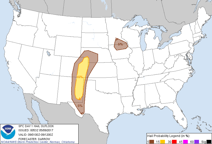
weaken due to capping. Hail/damaging winds are the primary threats
with convection this evening, although an isolated tornado can not
be ruled out with supercell activity over northeast NM.
...MN/IA...
Convection is gradually expanding across southern MN ahead of a weak
short-wave trough that has topped the central US ridge. 00z
sounding from MPX exhibits steep mid-level lapse rates and adequate
shear for a few strong elevated thunderstorm clusters. This
activity should spread southeast toward IL later this evening but
downstream buoyancy should prove insufficient for organized severe.
..Darrow.. 05/09/2017
CLICK TO GET WUUS01 PTSDY1 PRODUCT
NOTE: THE NEXT DAY 1 OUTLOOK IS SCHEDULED BY 0600Z