New York, NY...Philadelphia, PA...Baltimore, MD...Washington, DC...Pittsburgh, PA...
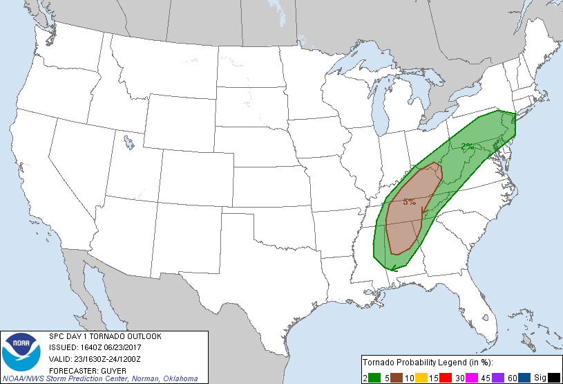
Probabilistic Damaging Wind Graphic
Probability of damaging thunderstorm winds or wind gusts of 50 knots or higher within 25 miles of a point. Hatched Area: 10% of greater probability of wind gusts 65 knots or greater within 25 miles of a point.
SPC AC 231640
Day 1 Convective Outlook
NWS Storm Prediction Center Norman OK
1140 AM CDT Fri Jun 23 2017
Valid 231630Z - 241200Z
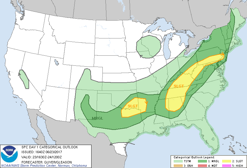
...THERE IS A SLIGHT RISK OF SEVERE THUNDERSTORMS FROM THE TN VALLEY
TO THE DELMARVA/MID-ATLANTIC REGION...
...THERE IS A SLIGHT RISK OF SEVERE THUNDERSTORMS ACROSS THE
SOUTHERN PLAINS/ARKLATEX...
...THERE IS A MARGINAL RISK OF SEVERE THUNDERSTORMS FROM PARTS OF
NM/SOUTHERN PLAINS TO APPALACHIANS/NEW ENGLAND...
...SUMMARY...
Damaging wind gusts and a few tornadoes are possible this afternoon
into evening from the Tennessee Valley toward parts of the
Appalachians. A few severe storms with strong wind gusts and hail
will also be possible across parts of the Northeast States and
southern Plains.
...TN Valley vicinity...
The remnants of Cindy will continue to spread east-northeastward
through the afternoon and evening, with a corridor of low/mid-level
winds preceding these remnants. A moist and increasingly uninhibited
boundary layer this afternoon should allow for the intensification
of a mixed mode of storms, including bands/clusters and the
possibility of some cluster-preceding semi-discrete supercells.
Given the magnitude of the low-level shear, especially from northern
AL into middle/eastern TN and eastern KY, the potential will exist
for a few tornadoes aside from some wind damage potential. Reference
Mesoscale Discussion 1130 for additional short-term details.
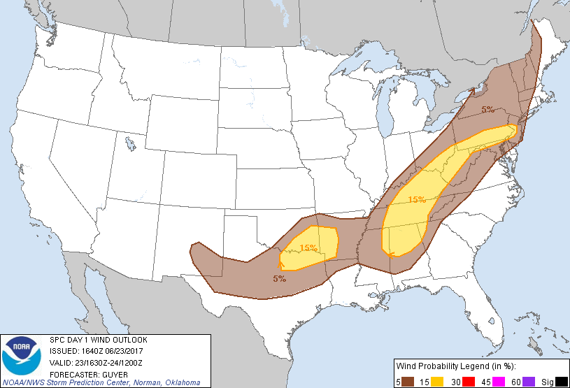
...Middle/upper OH River Valley to Delmarva/Mid-Atlantic...
As moisture continues to increase into the region, it appears that
pockets of locally stronger heating will occur today ahead, and on
the southern fringes, of upstream precipitation/thicker cloud cover.
A steadily strengthening wind field will overspread the region
through the afternoon and evening, with increasingly favorable wind
profiles for organized storms including a few supercells/bows.
Damaging winds should be the primary risk, but some hail and/or a
tornado are possible as well.
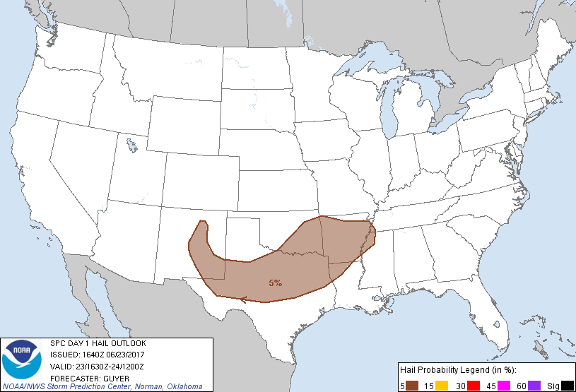
...Southern Plains/Ark-La-Tex/Mid-South...
Steep lapse rates and diabatic warming of the boundary layer will
promote moderate instability in this region. Storms will likely
develop along the south/southeastward-advancing cold front as well
as over the higher terrain over NM/west TX. Additionally, ongoing
storms across southwest MO may gradually increase in
coverage/intensity as they progress southeastward into AR. The warm
sector resides well south of the stronger winds aloft, but vertical
shear will be supportive of multicells capable of producing a few
strong to damaging wind gusts and marginally severe hail this
afternoon into evening.
...Northern NY/New England...
At least a few strong/severe thunderstorms are expected this
afternoon across northeast NY into northern New England.
..Guyer/Gleason.. 06/23/2017
CLICK TO GET WUUS01 PTSDY1 PRODUCT
NOTE: THE NEXT DAY 1 OUTLOOK IS SCHEDULED BY 2000Z