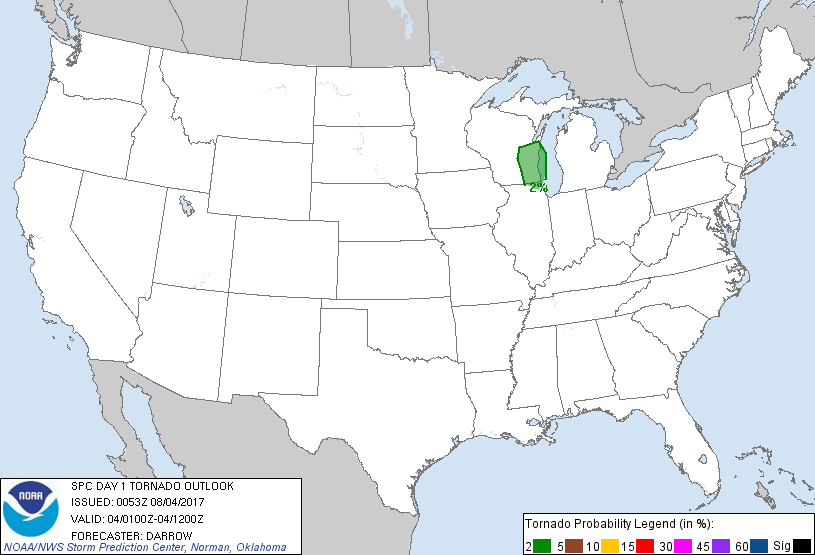
Probability of a tornado within 25 miles of a point. Hatched Area: 10% or greater probability of EF2 - EF5 tornadoes within 25 miles of a point.
Day 1 Tornado Risk
Area (sq. mi.)
Area Pop.
Some Larger Population Centers in Risk Area
2 %
13,620
4,251,302
Milwaukee, WI...Kenosha, WI...Waukegan, IL...Racine, WI...Arlington Heights, IL...
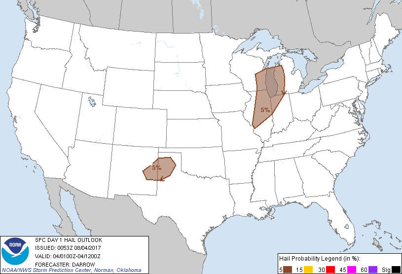
Probabilistic Damaging Wind Graphic
Probability of damaging thunderstorm winds or wind gusts of 50 knots or higher within 25 miles of a point. Hatched Area: 10% of greater probability of wind gusts 65 knots or greater within 25 miles of a point.
SPC AC 040053
Day 1 Convective Outlook
NWS Storm Prediction Center Norman OK
0753 PM CDT Thu Aug 03 2017
Valid 040100Z - 041200Z
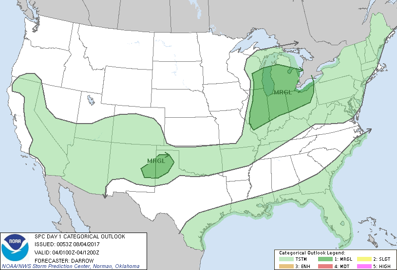
...THERE IS A MARGINAL RISK OF SEVERE THUNDERSTORMS FROM THE MIDWEST
TO THE OH VALLEY...
...THERE IS A MARGINAL RISK OF SEVERE THUNDERSTORMS ACROSS THE
SOUTHERN HIGH PLAINS...
...SUMMARY...
Isolated strong-severe thunderstorms will linger this evening across
portions of the Midwest into northern Ohio and over portions of the
southern High Plains. A few strong storms will persist for the next
few hours across the lower deserts of Arizona.
...Midwest/OH Valley...
Well-defined short-wave trough is progressing across the upper MS
Valley toward the Great Lakes with seasonally strong 500mb flow
(50kt) translating toward southern Lake MI. Height falls across this
region are strongly supportive of robust convection but severe
reports have been lacking with thunderstorms ahead of the cold front
from southern WI into central IL. Will maintain 5% severe threat for
thunderstorms ahead of the front tonight as strong shear and modest
instability remain favorable for a few strong storms. Although 00z
sounding from ILX exhibits MLCAPE in excess of 2000 J/kg mid-level
lapse rates, on the order of 5.5 C/km, are likely inhibiting the
strength of this activity.
...Southern High Plains...
Expansive precip shield has developed with High Plains convection
over northeast NM/western TX Panhandle. Loosely organized squall
line is embedded within this shield of precip and is propagating
southeast toward the TX South Plains. 00z sounding from AMA suggests
adequate shear for organized cluster of storms to persist this
evening through lapse rates/instability are not particularly strong
for early August. Isolated severe wind gust or perhaps some hail are
the primary threats.
...AZ...
Convection is coalescing across south-central AZ this evening where
boundary-layer air mass has yet to be disrupted. Seasonally high PW
values and temperatures in the upper 90s appear supportive of gusty
winds with storms as they propagate toward the international border.
..Darrow.. 08/04/2017
CLICK TO GET WUUS01 PTSDY1 PRODUCT
NOTE: THE NEXT DAY 1 OUTLOOK IS SCHEDULED BY 0600Z