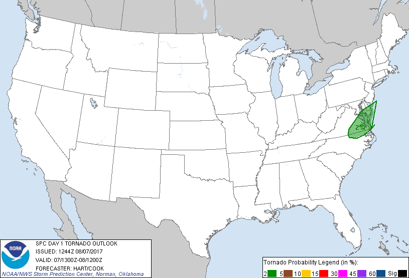
Probability of a tornado within 25 miles of a point. Hatched Area: 10% or greater probability of EF2 - EF5 tornadoes within 25 miles of a point.
Day 1 Tornado Risk
Area (sq. mi.)
Area Pop.
Some Larger Population Centers in Risk Area
2 %
22,805
3,816,152
Virginia Beach, VA...Norfolk, VA...Chesapeake, VA...Richmond, VA...Newport News, VA...
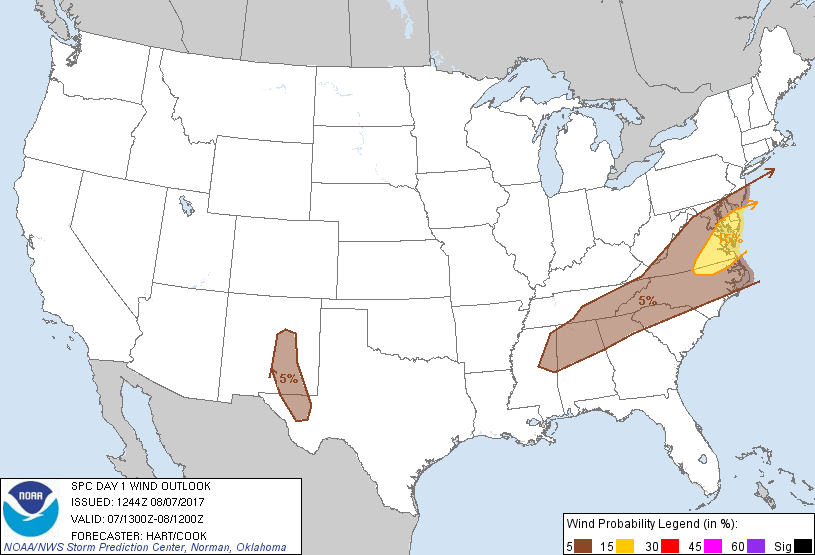
Probabilistic Damaging Wind Graphic
Probability of damaging thunderstorm winds or wind gusts of 50 knots or higher within 25 miles of a point. Hatched Area: 10% of greater probability of wind gusts 65 knots or greater within 25 miles of a point.
Day 1 Wind Risk
Area (sq. mi.)
Area Pop.
Some Larger Population Centers in Risk Area
15 %
23,163
3,854,225
Virginia Beach, VA...Norfolk, VA...Chesapeake, VA...Richmond, VA...Newport News, VA...
SPC AC 071244
Day 1 Convective Outlook
NWS Storm Prediction Center Norman OK
0744 AM CDT Mon Aug 07 2017
Valid 071300Z - 081200Z
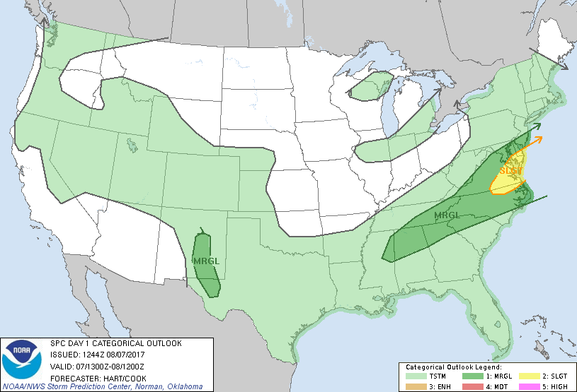
...THERE IS A SLIGHT RISK OF SEVERE THUNDERSTORMS OVER PARTS OF THE
MID ATLANTIC REGION...
...THERE IS A MARGINAL RISK OF SEVERE THUNDERSTORMS FROM NORTHERN MS
INTO THE MID ATLANTIC STATES...
...THERE IS A MARGINAL RISK OF SEVERE THUNDERSTORMS OVER PARTS OF
SOUTHEAST NM AND SOUTHWEST TX...
...SUMMARY...
Scattered thunderstorms with some severe potential are expected
across the Middle Atlantic Monday. A more isolated severe risk may
extend as far southwest as the southern Appalachians and over parts
of eastern New Mexico and Far West Texas.
...Mid Atlantic States...
Water vapor imagery shows a shortwave trough moving across KY/TN.
Widespread showers and thunderstorms have been ongoing overnight
ahead of the trough across much of WV/VA and western MD. This
activity will spread eastward through the morning hours, with a
marginal threat of a few strong wind gusts. In the wake of the
morning convection, it appears likely that skies will partially
clear over parts of VA/MD and northeast NC prior to the mid-level
shortwave trough passage. Forecast soundings in this region show
modest CAPE, but strong low-level vertical shear and helicity
values. This suggests a risk of a few supercells capable of
damaging wind gusts and/or an isolated tornado or two. The threat
should move offshore shortly after dark.
...Southern Appalachians...
Farther southwest, scattered thunderstorms are expected to intensify
this afternoon from western NC into parts of AL/MS within a corridor
of 20-30 kt steering flow. Pockets of moderate instability will
likely form in this region, with the risk of locally gusty/damaging
wind gusts in the strongest cells.
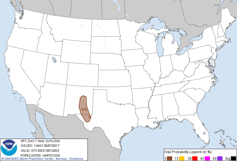
...Southeast NM/Southwest TX...
Isolated intense thunderstorms are possible this afternoon and
evening over parts of southeast NM and southwest TX. Northwest flow
aloft, atop weak southeasterly low-level winds will promote the
potential for rotating storms capable of gusty winds and some hail.
..Hart/Cook.. 08/07/2017
CLICK TO GET WUUS01 PTSDY1 PRODUCT
NOTE: THE NEXT DAY 1 OUTLOOK IS SCHEDULED BY 1630Z