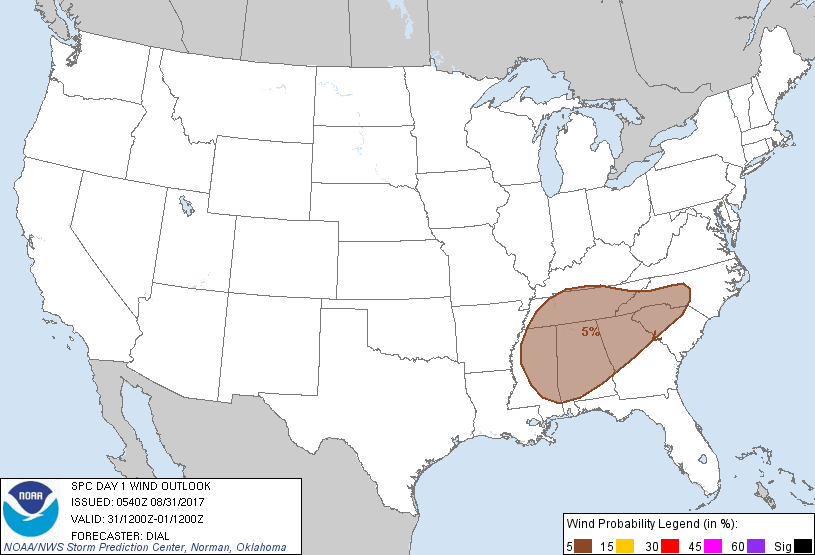
Probability of damaging thunderstorm winds or wind gusts of 50 knots or higher within 25 miles of a point. Hatched Area: 10% of greater probability of wind gusts 65 knots or greater within 25 miles of a point.
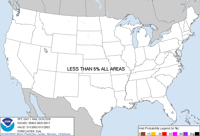
Probability of hail 1" or larger within 25 miles of a point. Hatched Area: 10% or greater probability of hail 2" or larger within 25 miles of a point.
Day 1 Hail Risk
Area (sq. mi.)
Area Pop.
Some Larger Population Centers in Risk Area
No Risk Areas Forecast
SPC AC 310540
Day 1 Convective Outlook
NWS Storm Prediction Center Norman OK
1240 AM CDT Thu Aug 31 2017
Valid 311200Z - 011200Z
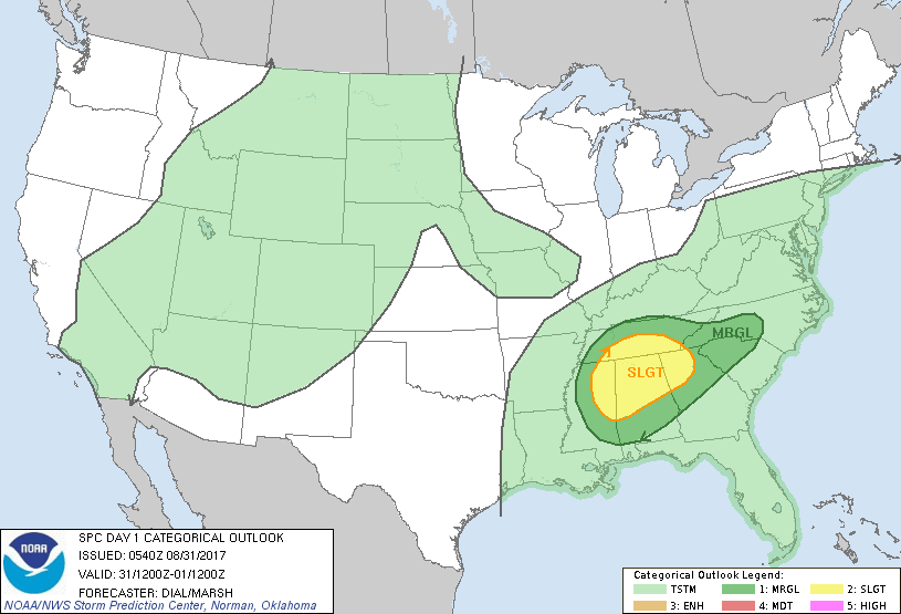
...THERE IS A SLIGHT RISK OF SEVERE THUNDERSTORMS FROM A PORTION OF
THE CENTRAL GULF COAST STATES INTO THE TENNESSEE VALLEY...
...THERE IS A MARGINAL RISK OF SEVERE THUNDERSTORMS OVER A LARGE
PORTION OF THE SOUTHEAST STATES...
...SUMMARY...
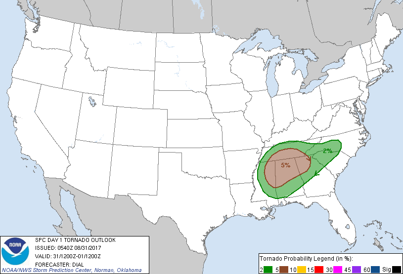
The risk for a few tornadoes will persist today from the central
Gulf Coast states to the Tennessee Valley and Carolinas Piedmont in
association with the remnants of Harvey.
...Synopsis...
Primary feature of interest today will be the remnants of Harvey.
This system has been downgraded to a tropical depression by the
National Hurricane Center and is forecast to continue a slow
northeast track into northern MS by late this afternoon, then into
middle TN by the end of this period. A warm front extending east
from the center will advance northward, reaching the TN Valley this
evening.
...Portions of Gulf Coast States into the Tennessee Valley and
western Carolinas...
Satellite imagery indicates Harvey continues to entrain middle to
high-level dry air as it transitions to a hybrid subtropical system.
This process will increase potential for partial clearing and
corridors of solar heating between convergence bands during the day.
Storms will likely redevelop within the bands as the boundary layer
destabilizes. Greatest tornado threat should occur as north-moving
storms interact with the warm front and where 0-1 km storm-relative
helicity will be maximized in proximity to the low-level jet from
early afternoon into the evening.
..Dial/Marsh.. 08/31/2017
CLICK TO GET WUUS01 PTSDY1 PRODUCT
NOTE: THE NEXT DAY 1 OUTLOOK IS SCHEDULED BY 1300Z