SPC AC 130039
Day 1 Convective Outlook
NWS Storm Prediction Center Norman OK
0739 PM CDT Tue Sep 12 2017
Valid 130100Z - 131200Z
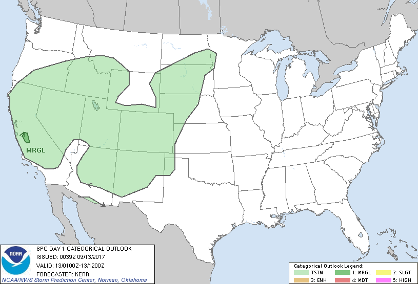
...THERE IS A MARGINAL RISK OF SEVERE THUNDERSTORMS THIS EVENING
ACROSS PORTIONS OF THE SAN JOAQUIN VALLEY...
...SUMMARY...
Isolated strong thunderstorm development still appears possible this
evening across parts of the San Joaquin Valley, mainly to the west
and southwest of Fresno and Merced, accompanied by some risk for
localized potentially damaging wind gusts.
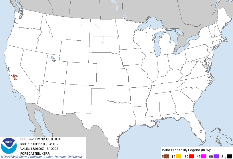
...01Z Outlook Update...
...California...
Confidence in thunderstorm development along the coastal ranges to
the south of the San Francisco Bay area within the next few hours is
diminishing. But persistent attempts at deepening convective
development are evident along the mountains west/southwest of Fresno
and Merced, where the boundary layer remains hot (temps in the mid
90s F) and deeply mixed. If a thunderstorm can emerge from this
activity prior to 02-03Z, 30+ kt cyclonic flow in the 700-500 mb
layer may still contribute to a risk for potentially damaging wind
gusts before diurnal surface cooling begins to stabilize the near
surface environment more appreciably.
Otherwise, the initiation of some thunderstorm activity near and
south of San Francisco Bay with the gradual inland progression of
the offshore closed low now appears more probable late tonight
(09-12Z). This may be accompanied by a risk for small hail and
perhaps gusty winds, but severe weather potential appears limited.
Elsewhere, scattered vigorous thunderstorm activity persists along
the Sierra Nevada, southward into the Mojave Desert. Isolated
stronger cells along the Sierra Nevada may be accompanied by some
small hail, while activity within the hot and deeply mixed boundary
layer across the Mojave Desert may be accompanied by locally strong
surface gusts. But this activity is likely to diminish in intensity
during the 02-04Z time frame, if not before.
..Kerr.. 09/13/2017
CLICK TO GET WUUS01 PTSDY1 PRODUCT
NOTE: THE NEXT DAY 1 OUTLOOK IS SCHEDULED BY 0600Z
|