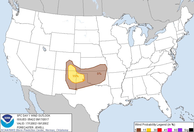
Probability of damaging thunderstorm winds or wind gusts of 50 knots or higher within 25 miles of a point. Hatched Area: 10% of greater probability of wind gusts 65 knots or greater within 25 miles of a point.
Oklahoma City, OK...Tulsa, OK...Colorado Springs, CO...Wichita, KS...Lubbock, TX...
SPC AC 170542
Day 1 Convective Outlook
NWS Storm Prediction Center Norman OK
1242 AM CDT Sun Sep 17 2017
Valid 171200Z - 181200Z
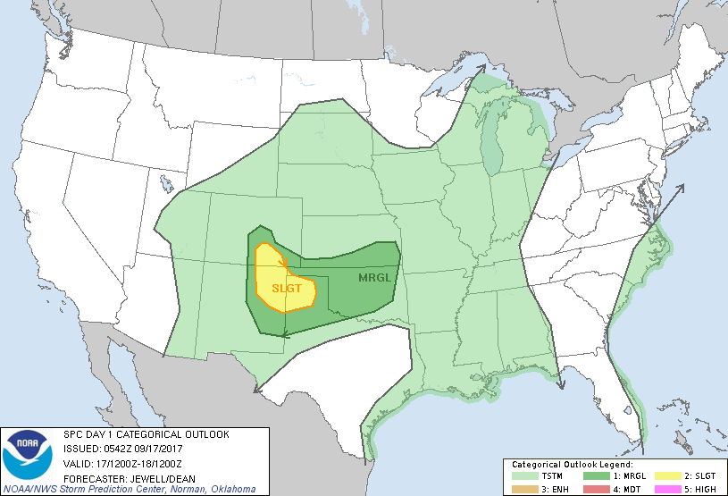
...THERE IS A SLIGHT RISK OF SEVERE THUNDERSTORMS OVER NORTHEAST
NM...SOUTHEAST CO...AND INTO THE TX PANHANDLE...
...THERE IS A MARGINAL RISK OF SEVERE THUNDERSTORMS FROM THE CENTRAL
AND SOUTHERN HIGH PLAINS INTO OK AND SOUTHERN KS...
...SUMMARY...
A few severe thunderstorms are expected today with large hail and
strong wind gusts across portions of the central and southern High
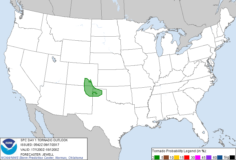
Plains, and into Oklahoma and southern Kansas. A brief/weak tornado
cannot be ruled out over the southern High Plains.
...Synopsis...
A shortwave trough will quickly eject northeastward across the Upper
MS Valley as a larger trough develops into the Pacific Northwest. At
the surface, high pressure will stretch from the Central Plains into
the Upper MS Valley, with a cold front moving into the Upper Great
Lakes. Southern portions of this front will become stationary across
KS, OK and the TX Panhandle, retreating northward by evening. Modest
southwesterly flow as well as cool temperatures aloft will remain
over the central Rockies and into the Plains, which will contribute
to severe thunderstorm potential developing over CO and NM,
progressing eastward overnight.
...Central and southern High Plains...
Veering surface winds will back low-level moisture westward during
the day with strong heating across the Front Range and south of the
front into TX. Storms are expected to initiate by midday over the
higher terrain, and move into the Plains during the late afternoon
and evening. Midlevel flow around 35 kt atop low-level
southeasterlies will lengthen hodographs and support a few
eastward-moving cells, with large hail most likely. Supercells are
possible with storms tracking near the boundary, and a brief/weak
tornado could occur.
Other daytime storms are likely near the old front and/or outflow
across much of OK into southeast KS and western MO. Here, shear will
be weaker, but moisture will be more robust and with no capping by
afternoon. A few storms may produce hail, with locally strong
outflow winds the most likely threat.
..Jewell/Dean.. 09/17/2017
CLICK TO GET WUUS01 PTSDY1 PRODUCT
NOTE: THE NEXT DAY 1 OUTLOOK IS SCHEDULED BY 1300Z