Probability of a tornado within 25 miles of a point. Hatched Area: 10% or greater probability of EF2 - EF5 tornadoes within 25 miles of a point.
Day 1 Tornado Risk
Area (sq. mi.)
Area Pop.
Some Larger Population Centers in Risk Area
No Risk Areas Forecast
Probabilistic Damaging Wind Graphic
Probability of damaging thunderstorm winds or wind gusts of 50 knots or higher within 25 miles of a point. Hatched Area: 10% of greater probability of wind gusts 65 knots or greater within 25 miles of a point.
Day 1 Wind Risk
Area (sq. mi.)
Area Pop.
Some Larger Population Centers in Risk Area
No Risk Areas Forecast
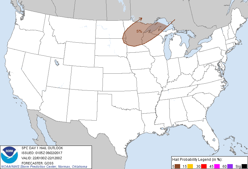
Probabilistic Large Hail Graphic
Probability of hail 1" or larger within 25 miles of a point. Hatched Area: 10% or greater probability of hail 2" or larger within 25 miles of a point.
SPC AC 220105
Day 1 Convective Outlook
NWS Storm Prediction Center Norman OK
0805 PM CDT Thu Sep 21 2017
Valid 220100Z - 221200Z
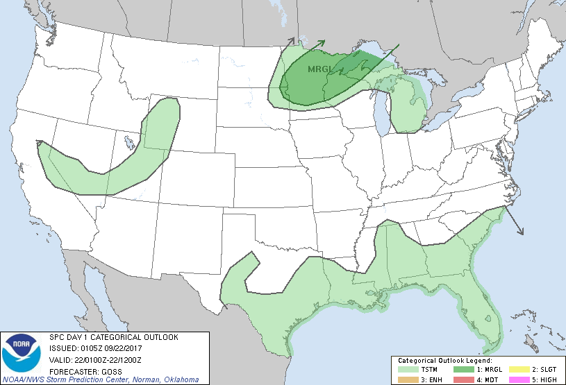
...THERE IS A MARGINAL RISK OF SEVERE THUNDERSTORMS FROM PORTIONS OF
SOUTHEAST ND/NORTHEAST SD EASTWARD INTO THE WESTERN UPPER GREAT
LAKES AREA...
...SUMMARY...
A marginal risk for a few large hail events exists over a part of
the Upper Midwest tonight into Friday morning.
...MN/northern WI/western Upper MI and vicinity...
A weak short-wave trough moving northeast across the central U.S.
this evening will combine with the beginnings of an observed
increase in the southerly low-level jet to yield some enhancement of
quasi-geostropic ascent across north-central portions of the country
tonight. This increase in ascent -- given favorable elevated
instability indicated by evening RAOBs -- may prove sufficient for
development of isolated/elevated storms. Certainty regarding degree
of convective coverage remains elusive, as sampling of a large
number of CAM runs reveals solutions ranging from very little if any
convection to scattered coverage of intense updrafts.
With cloud-layer shear sufficient for updraft organization and CAPE
favorable for intense cells, will maintain 5% risk for hail across
this region, but conditionality of the risk precludes SLGT risk
upgrade.
..Goss.. 09/22/2017
CLICK TO GET WUUS01 PTSDY1 PRODUCT
NOTE: THE NEXT DAY 1 OUTLOOK IS SCHEDULED BY 0600Z