Probability of damaging thunderstorm winds or wind gusts of 50 knots or higher within 25 miles of a point. Hatched Area: 10% of greater probability of wind gusts 65 knots or greater within 25 miles of a point.
Baltimore, MD...Washington, DC...Virginia Beach, VA...Norfolk, VA...Chesapeake, VA...
Probabilistic Large Hail Graphic
Probability of hail 1" or larger within 25 miles of a point. Hatched Area: 10% or greater probability of hail 2" or larger within 25 miles of a point.
Day 1 Hail Risk
Area (sq. mi.)
Area Pop.
Some Larger Population Centers in Risk Area
No Risk Areas Forecast
SPC AC 240032
Day 1 Convective Outlook
NWS Storm Prediction Center Norman OK
0732 PM CDT Mon Oct 23 2017
Valid 240100Z - 241200Z
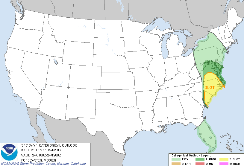
...THERE IS A SLIGHT RISK OF SEVERE THUNDERSTORMS FROM THE CENTRAL
CAROLINAS INTO SOUTH-CENTRAL VIRGINIA...
...THERE IS A MARGINAL RISK OF SEVERE THUNDERSTORMS FROM THE CENTRAL
CAROLINAS INTO THE MID-ATLANTIC STATES...
...SUMMARY...
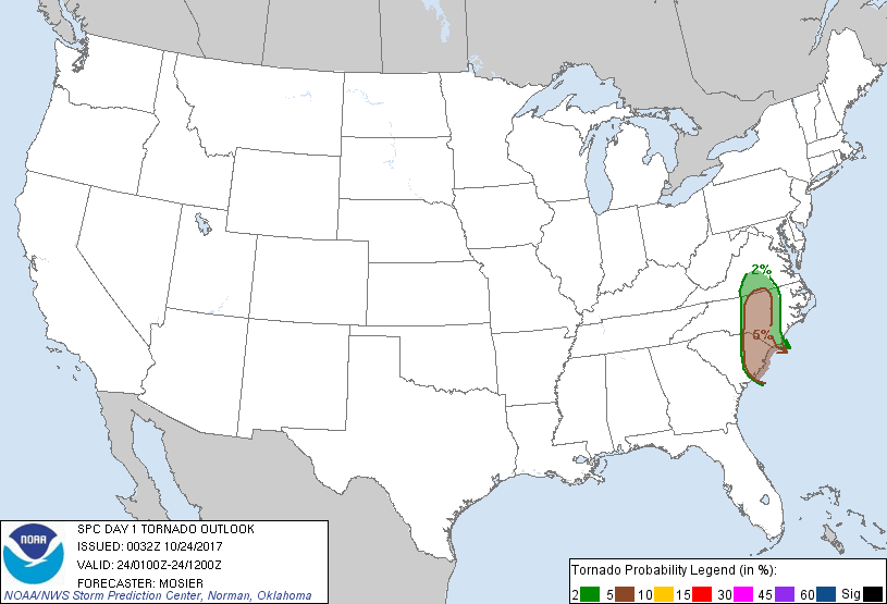
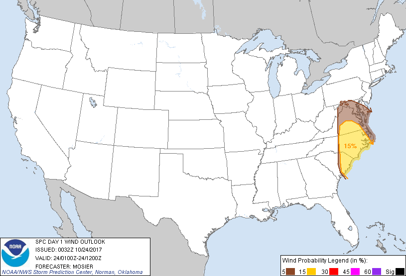
Isolated strong to severe storms should persist over the
Mid-Atlantic and central/eastern Carolinas through the evening. The
main threats will be damaging wind gusts and a tornado or two.
...Mid-Atlantic south into the eastern Carolinas...
A negatively tilted shortwave trough continues to progress through
the region, providing ample forcing for ascent for thunderstorms,
despite modest instability. Line of storms currently extending from
western VA southward through the central Carolinas is expected to
continue east-northeastward during the next several hours. Modest
instability (i.e. MLCAPE generally from 100-250 J/kg) will likely
limit overall storm strength and persistence. Even so, strong wind
fields are supportive of veering wind profiles (sampled well by the
00Z CHS sounding) favorable for rotating thunderstorms with the
potential for a tornado or two within the strongest updrafts.
Enhanced downdrafts resulting from updraft rotation may result in a
few damaging wind gusts as well. Recent CAPPI data has actually
shown modest increases in storm intensity (particularly across
central NC) and the general expectation is for the storms to remain
strong enough to produce severe weather for at least the next few
hours.
..Mosier.. 10/24/2017
CLICK TO GET WUUS01 PTSDY1 PRODUCT
NOTE: THE NEXT DAY 1 OUTLOOK IS SCHEDULED BY 0600Z