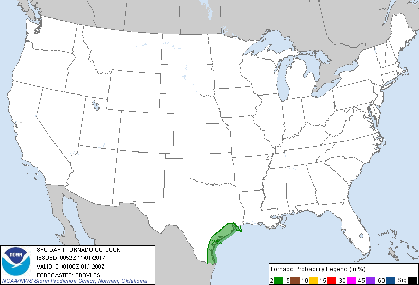
Probability of a tornado within 25 miles of a point. Hatched Area: 10% or greater probability of EF2 - EF5 tornadoes within 25 miles of a point.
Day 1 Tornado Risk
Area (sq. mi.)
Area Pop.
Some Larger Population Centers in Risk Area
2 %
17,907
5,167,656
Houston, TX...Corpus Christi, TX...Pasadena, TX...Sugar Land, TX...Missouri City, TX...
Probabilistic Damaging Wind Graphic
Probability of damaging thunderstorm winds or wind gusts of 50 knots or higher within 25 miles of a point. Hatched Area: 10% of greater probability of wind gusts 65 knots or greater within 25 miles of a point.
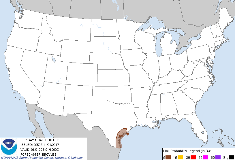
Probability of hail 1" or larger within 25 miles of a point. Hatched Area: 10% or greater probability of hail 2" or larger within 25 miles of a point.
Day 1 Hail Risk
Area (sq. mi.)
Area Pop.
Some Larger Population Centers in Risk Area
5 %
14,859
1,198,162
Corpus Christi, TX...Brownsville, TX...Harlingen, TX...Victoria, TX...Kingsville, TX...
SPC AC 010052
Day 1 Convective Outlook
NWS Storm Prediction Center Norman OK
0752 PM CDT Tue Oct 31 2017
Valid 010100Z - 011200Z
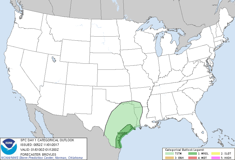
...THERE IS A MARGINAL RISK OF SEVERE THUNDERSTORMS ACROSS PARTS OF
THE TEXAS COASTAL PLAINS...
...SUMMARY...
Isolated marginally severe storms are possible across parts of the
Texas Coastal Plains from this evening through tonight into early
Wednesday morning.
...Texas Coastal Plains...
An upper-level trough will continue to move slowly eastward across
the southern Plains tonight. Low-level flow ahead of the trough will
be maintained helping to keep a moist airmass in place along the
Texas Coast. Although instability will remain weak, surface
dewpoints will be from the mid 60s to the lower 70s F across the
Texas Coastal Plains. This combined with strong low-level shear (0-1
km shear of 25 to 30 kt) and moderate deep-layer shear may be enough
for a marginal severe threat. If surface-based thunderstorms can
develop late this evening or tonight, then a marginal tornado threat
would be possible. A potential for strong gusty winds or hail may
also develop late this evening or during the overnight period.
..Broyles.. 11/01/2017
CLICK TO GET WUUS01 PTSDY1 PRODUCT
NOTE: THE NEXT DAY 1 OUTLOOK IS SCHEDULED BY 0600Z