Probability of damaging thunderstorm winds or wind gusts of 50 knots or higher within 25 miles of a point. Hatched Area: 10% of greater probability of wind gusts 65 knots or greater within 25 miles of a point.
SPC AC 021948
Day 1 Convective Outlook
NWS Storm Prediction Center Norman OK
0248 PM CDT Thu Nov 02 2017
Valid 022000Z - 031200Z
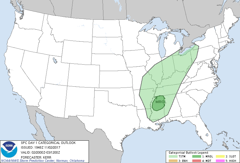
...THERE IS A MARGINAL RISK OF SEVERE THUNDERSTORMS LATE THIS
AFTERNOON AND EVENING ACROSS PARTS OF NORTHERN MISSISSIPPI AND
ADJACENT PORTIONS OF NORTHWESTERN ALABAMA...
...SUMMARY...
A couple of strong thunderstorms could impact parts of northern
Mississippi and adjacent portions of northwest Alabama late this
afternoon and evening, accompanied by some risk for severe weather.
...20Z Outlook Update...
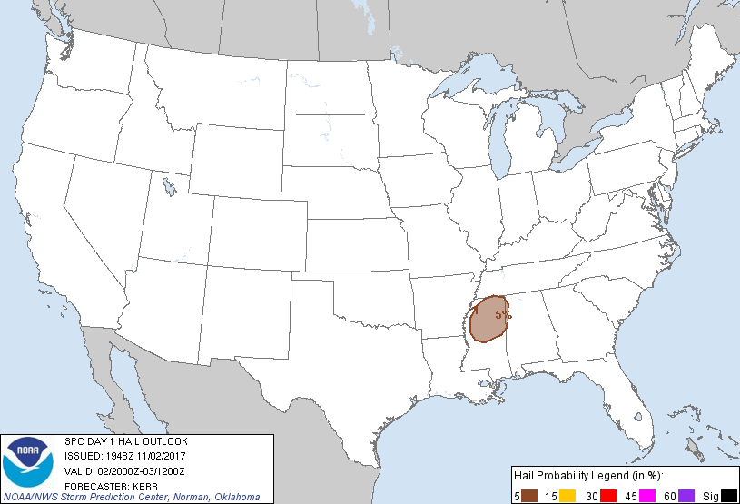
A substantive influx of moisture (characterized by upper 60s to near
70f surface dew points) is ongoing on south/southwesterly low-level
flow off the western Gulf of Mexico. This is contributing to a
sizable area of weak to moderate potential instability, from parts
of the southeastern lower Plains and Ozark Plateau through the lower
half of the Mississippi Valley. CAPE is maximized from southeast
Texas into the Ozark Plateau, where lower/mid tropospheric lapse
rates are steepening as elevated mixed-layer air advects east of the
southern Plains. However, mid-level inhibition is also increasing,
and may tend to suppress convective development.
In general, mid-level heights are also rising appreciably within
both branches of the split upper flow, through most areas across and
east of the Rockies. However, a weak southern branch
perturbation/cyclonic vorticity center now crossing southeastern
Arkansas does appear to be suppressing mid-level height rises. As
this feature gradually shifts eastward/northeastward late this
afternoon and evening, associated forcing for ascent could enhance
showers now likely forming in response to low-level warm advection
across parts of northern Mississippi.
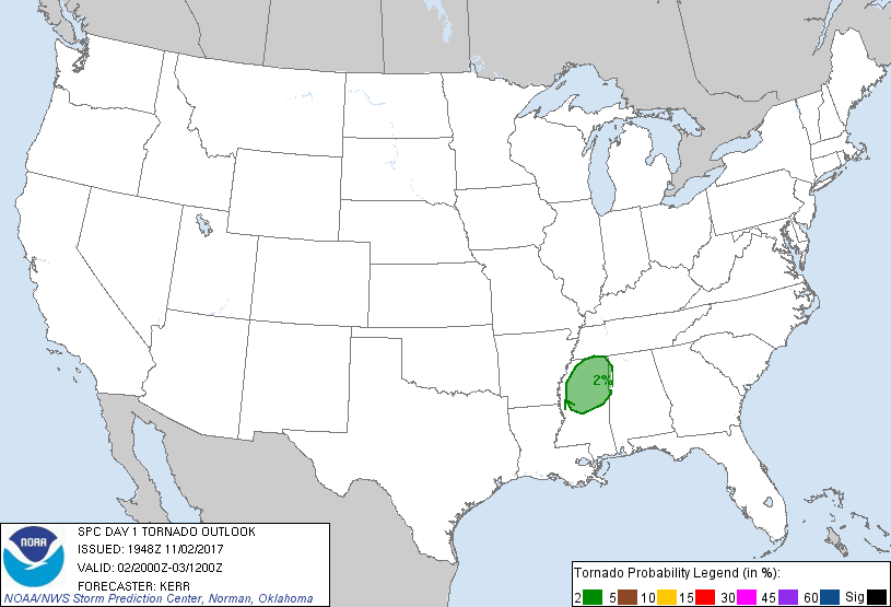
Prior to the onset of boundary layer cooling this evening, some
strengthening of mid-level wind fields and shear appear possible
with the progression of the upper impulse, across northern
Mississippi. And there still appears a window of opportunity for a
couple of storms to develop and intensify within an environment
becoming marginally conducive to supercells.
Farther north, across parts of southeastern Missouri and
northeastern Arkansas into the lower Ohio Valley, guidance is
suggestive that an increasing divergent upper flow field between the
two branches of westerlies, coupled with the ongoing
destabilization, could contribute to increasing thunderstorm
development. However, this seems most probable after dark, with
activity tending to be rooted above the stable or stabilizing
boundary layer. Depending on the timing of initiation, and residual
boundary layer instability, a window of opportunity for
strong/severe storm development may not be entirely out of the
question. But, this still seems even more uncertain than the
potential farther to the south (across northern Mississippi). As a
result, severe weather probabilities are being maintained at less
than 5 percent.
..Kerr.. 11/02/2017
.PREV DISCUSSION... /ISSUED 1130 AM CDT Thu Nov 02 2017/
...Northern portions of Mississippi and Alabama...
A weak mid-level impulse over the Ark-La-Tex this morning will
continue eastward and cross the region later this afternoon into
early evening. Low clouds remain relatively prevalent across
northern portions of MS and AL late this morning, but a gradual
erosion of low-level clouds will occur this afternoon while the
boundary layer otherwise continues to moisten (middle to upper 60s F
surface dewpoints). Ascent related to the aforementioned mid-level
impulse should contribute to isolated thunderstorm development by
mid/late afternoon within an increasingly unstable air mass,
particularly across northern MS.
While mid-level winds this morning (12Z observed soundings) were
relatively weak, a gradual strengthening will occur today with
deep-layer shear increasing to around 35-40 kt by late afternoon.
This would conditionally support a supercell mode with all severe
hazards possible, potentially including a tornado risk in the
presence of a sufficiently moist environment and approximately
150-200 m2/s2 0-1 km SRH.
...Southeast Missouri to central/southern Indiana...
Scattered convection should develop and increase this evening along
a cold front that will accelerate southeastward across the Midwest
towards the Ohio Valley. With both low and mid-level winds
decreasing in time ahead of the front, deep-layer shear will likely
be modest, especially compared to typical late autumn severe setups.
Even though low-level moistening will be occurring ahead of the
front, current thinking is that near-surface inhibition and the
undercutting nature of the front should limit surface-based
convection. Additionally, hail beyond small sizes appears rather
unlikely given relatively weak mid-level lapse rates.
Observational/short-term guidance will be reevaluated through the
afternoon for any possible needed introduction of low severe
probabilities across this region.
CLICK TO GET WUUS01 PTSDY1 PRODUCT
NOTE: THE NEXT DAY 1 OUTLOOK IS SCHEDULED BY 0100Z