Probability of a tornado within 25 miles of a point. Hatched Area: 10% or greater probability of EF2 - EF5 tornadoes within 25 miles of a point.
Day 1 Tornado Risk
Area (sq. mi.)
Area Pop.
Some Larger Population Centers in Risk Area
No Risk Areas Forecast
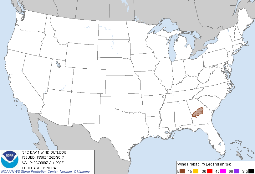
Probabilistic Damaging Wind Graphic
Probability of damaging thunderstorm winds or wind gusts of 50 knots or higher within 25 miles of a point. Hatched Area: 10% of greater probability of wind gusts 65 knots or greater within 25 miles of a point.
Probability of hail 1" or larger within 25 miles of a point. Hatched Area: 10% or greater probability of hail 2" or larger within 25 miles of a point.
Day 1 Hail Risk
Area (sq. mi.)
Area Pop.
Some Larger Population Centers in Risk Area
No Risk Areas Forecast
SPC AC 201958
Day 1 Convective Outlook
NWS Storm Prediction Center Norman OK
0158 PM CST Wed Dec 20 2017
Valid 202000Z - 211200Z
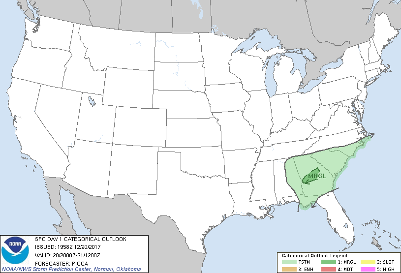
...THERE IS A MARGINAL RISK OF SEVERE THUNDERSTORMS ACROSS PARTS OF
CENTRAL GEORGIA...
...SUMMARY...
A strong storm or two remains possible across central Georgia late
this afternoon.
...Discussion...
Marginal probabilities have been focused along/ahead of broken
convective bands over central Georgia. KJGX VWP data continue to
indicate ample low-level flow for maintenance of a few small bowing
segments perhaps capable of a strong gust or two. However, with
continued eastward extent, slightly lower surface dew points and
related weaker buoyancy should continue an overall weakening trend
with this convection.
..Picca.. 12/20/2017
.PREV DISCUSSION... /ISSUED 1032 AM CST Wed Dec 20 2017/
...Deep South...
Bands of showers and a couple of embedded thunderstorms continue to
progress generally eastward late this morning across northern GA,
eastern/southern AL and extreme southeast MS. Within a high
shear/weak CAPE regime, most of this low-topped convection is
linearly organized with a few weak/transient mesovortices noted
since daybreak across parts of AL. This activity is occurring ahead
of a surface low located near the MS/TN border as of 16Z and
along/south of a semi-stationary front that extends eastward across
north-central AL/GA into SC.
The increasingly open mid-level wave, centered over the Ozarks late
this morning, will continue steadily eastward toward the coastal
Carolinas by late this evening. Even with some weakening of this
mid-level trough, low/mid-tropospheric winds will remain very strong
while continuing to become largely unidirectional
(west-southwesterly) over time. Thermodynamic limitations are likely
to preclude an organized/sustained severe risk. Cloud cover remains
prevalent within the warm sector and most of the convection/forcing
for ascent will tend to outrun the more appreciable low-level
moistening and destabilization. While the overall risk should wane
by late afternoon/evening, localized wind damage and/or perhaps even
a brief tornado cannot be ruled out with some of the more sustained
low-topped convection this afternoon.
CLICK TO GET WUUS01 PTSDY1 PRODUCT
NOTE: THE NEXT DAY 1 OUTLOOK IS SCHEDULED BY 0100Z