SPC AC 081729
Day 2 Convective Outlook
NWS Storm Prediction Center Norman OK
1129 AM CST Wed Mar 08 2017
Valid 091200Z - 101200Z
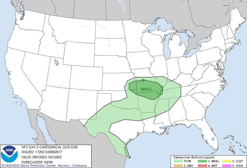
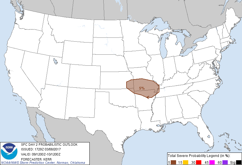
...THERE IS A MARGINAL RISK OF SEVERE THUNDERSTORMS ACROSS PARTS OF
THE OZARK PLATEAU REGION AND ADJACENT PORTIONS OF THE CENTRAL PLAINS
AND MIDDLE MISSISSIPPI VALLEY...
...SUMMARY...
Strong thunderstorms may impact parts of the Ozark Plateau region
Thursday afternoon and evening, accompanied by at least some risk
for severe hail and strong wind gusts.
...Synopsis...
Models indicate that the upper flow pattern will undergo at least
some amplification during this forecast period, particularly east of
the Rockies through the Atlantic Seaboard. Within the stronger belt
of westerlies emanating from the mid-latitude Pacific, broad upper
ridging appears likely to build across the eastern Pacific through
the Rockies and Plains, Thursday into Thursday night, while
downstream troughing digs east of the Mississippi Valley through the
western Atlantic.
A vigorous short wave impulse within this latter (cyclonic) regime
is forecast to dig across parts of the Upper Midwest and Great Lakes
region, accompanied by a substantive reinforcing intrusion of cold
air to the lee of the Rockies. The leading edge of this air mass is
expected to reach the Mid Atlantic Coast, Ohio Valley, Ozark Plateau
and south central Plains by 12z Friday. Ahead of this front, modest
moisture return in the wake of a preceding front may contribute to
considerable destabilization beneath a plume of steep mid-level
lapse rates, from the vicinity of the lower Rio Grande Valley
northeastward into the Ozark Plateau region. Despite an increase in
potential instability, forcing sufficient to overcome mid-level
inhibition and support the initiation of storms remains unclear at
this time, aside from terrain related forcing near/west of the Rio
Grande River, and a zone of enhanced lower/mid tropospheric warm
advection expected to develop and shift southeastward across parts
of the Ozark Plateau region by Thursday evening.
...Ozark Plateau and surrounding areas...
Based on latest model output, at least scattered thunderstorm
development appears likely within an east southeastward developing
zone of enhanced lower/mid tropospheric warm advection, as it
encounters a better low-level moisture return. This may initiate as
early as late afternoon across parts of southeast Kansas
(particularly near/north of Chanute), before increasing while
spreading east southeastward across the Missouri Ozarks, into south
central Missouri, by late Thursday evening.
Near the southwestern edge of the stronger cyclonic mid-level flow
(50+ kt at 500 mb), deep layer vertical shear probably will be more
than sufficient for organized severe storm potential. Given the
likely presence of at least steep mid-level lapse rates, the
magnitude of the low-level moisture return and its influence on
destabilization remains the primary uncertainty concerning the
extent of the convective potential. This is a point of considerable
model spread. Taking into consideration a most probable solution
somewhere between that currently depicted by the aggressive NAM and
much more modest GFS (with respect to destabilization), there is
support for at least some severe weather potential with anticipated
thunderstorm development.
Activity may remain mostly rooted within the elevated warm advection
regime, with severe hail and locally strong surface gusts the
primary severe threats. It is possible that this could spread into
upper portions of the lower Mississippi Valley by late Thursday
night.
..Kerr.. 03/08/2017
CLICK TO GET WUUS02 PTSDY2 PRODUCT
NOTE: THE NEXT DAY 2 OUTLOOK IS SCHEDULED BY 0700Z