SPC AC 231726
Day 2 Convective Outlook
NWS Storm Prediction Center Norman OK
1226 PM CDT Sun Apr 23 2017
Valid 241200Z - 251200Z
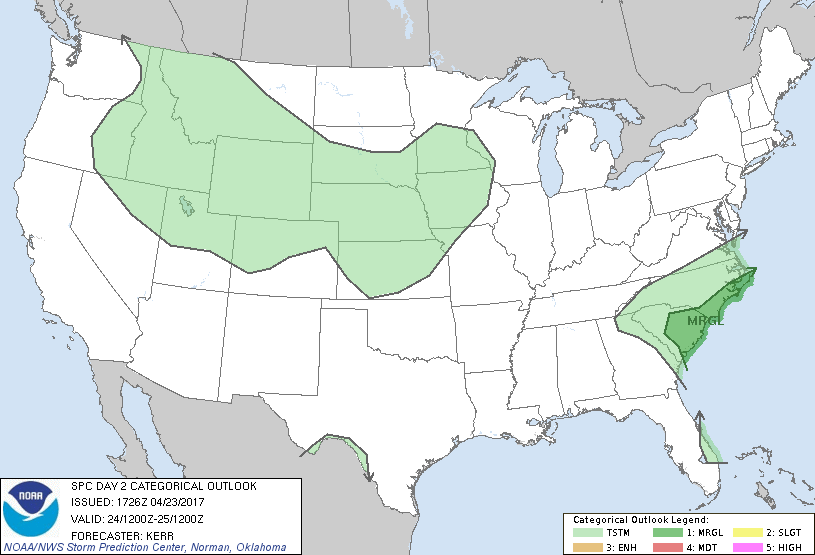
...THERE IS A MARGINAL RISK OF SEVERE THUNDERSTORMS MONDAY ACROSS
THE CAROLINA COASTAL PLAIN AND PARTS OF THE ADJACENT PIEDMONT...
...SUMMARY...
Thunderstorms accompanied by at least some severe weather potential
may impact the Carolina coastal plain and portions of the adjacent
piedmont Monday.
...Synopsis...
Models indicate that a strong belt of westerlies, traversing much of
the mid-latitude Pacific into the interior western U.S., will
undergo some amplification during this period. As broad mid/upper
ridging builds across the eastern Pacific through the U.S. Pacific
coast, broad downstream troughing appears likely to evolve near the
nose of the stronger flow, across the Great Basin and Rockies. In
lower levels, an initial surface cyclone, developing to the lee of
the Rockies in association with this regime, appears likely to
migrate northeast of the Black Hills region and weaken during the
day Monday, with new surface cyclogenesis taking place near/north of
the Texas/Oklahoma Panhandle region late Monday through Monday
night.
Meanwhile, within split westerlies downstream of the Rockies, broad
ridging within the northern stream is expected to build across and
northeast of the Great Lakes region. Within the southern stream,
troughing over the Southeast may gradually pivot from a neutral to
negative tilt while progressing east of the Atlantic coast. As it
does, a modest embedded lower/mid tropospheric cyclone is forecast
to redevelop from near or just south of the southern Appalachians
into areas near or east of the Carolina coast by 12Z Tuesday.
Appreciable spread is evident among the various models, and within
their respective ensemble output, concerning these developments and
possible interaction/consolidation with an impulse within the
subtropical westerlies (now progressing across/northeast of southern
Florida and the Bahamas).
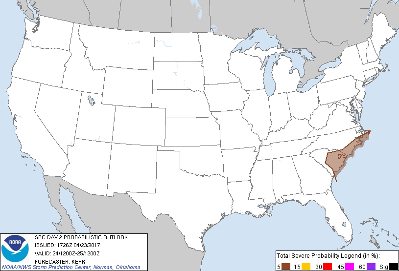
...South Atlantic Coast...
It remains unclear what, if any, impact that the model spread
concerning the evolution of the synoptic system will have on the
forecast for this period. Even though it appears that the highest
moisture content air (characterized by 70F+ surface dew points) will
generally remain confined to areas well offshore, a substantive
influx of moisture still seems likely across/inland of the Carolina
coast. This is expected to contribute to sufficient destabilization
for considerable convective development. The extent to which
mid-level cooling is able to steepen lower/mid tropospheric lapse
rates remains uncertain, and it is not clear that there will be
sufficient breaks in the overcast across inland areas to allow for
appreciable surface heating. Deep layer mean wind fields and shear
within the warm sector of the low may not be much more than 30 kt.
However, it may not be out of the question that the environment
could become conducive to thunderstorms with at least some severe
weather potential, mainly across parts of the South Carolina
piedmont into coastal plain during the day Monday, and perhaps the
North Carolina coastal plain Monday night.
...Nrn intermountain region/Rockies into north central Plains...
Steepening of lapse rates associated with mid-level cooling, and the
northeastward advection of elevated mixed layer air to the lee of
the southern Rockies, may contribute to sufficient destabilization
for at least widely scattered thunderstorm activity, in the presence
of favorable orographic and synoptic forcing for ascent. This
probably will be accompanied by at least some potential for hail in
stronger cells, including activity based within lower/mid
tropospheric warm advection across parts of the north central Plains
Monday into Monday night. However, destabilization, in general,
will be substantially inhibited across the Plains by the lack of a
substantive return flow of moisture off the Gulf of Mexico, in the
wake of the Southeastern system. And pockets of potentially
substantive destabilization across the Rockies and intermountain
region remain too uncertain (and likely to remain rather sparse) to
allow a forecast of 5 percent severe probabilities at this time.
..Kerr.. 04/23/2017
CLICK TO GET WUUS02 PTSDY2 PRODUCT
NOTE: THE NEXT DAY 2 OUTLOOK IS SCHEDULED BY 0600Z