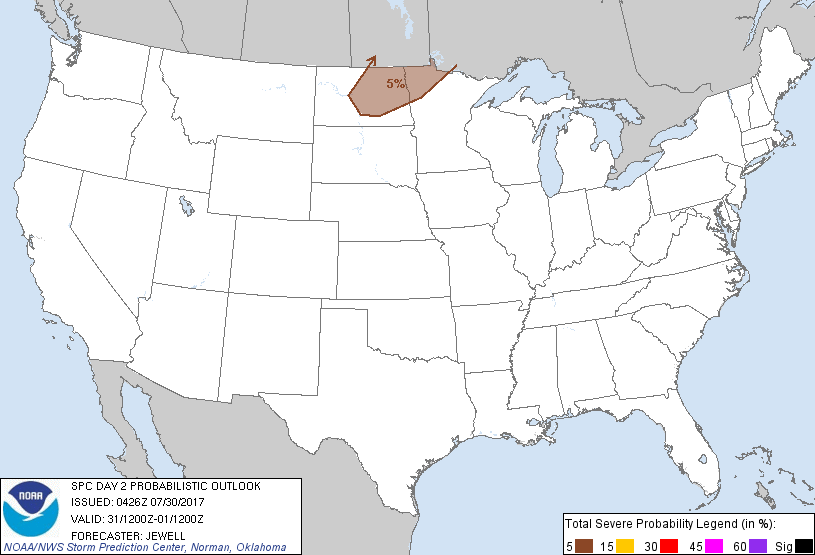
Grand Forks, ND...Jamestown, ND...Devils Lake, ND...Valley City, ND...Grafton, ND...
Probabilistic Graphic
Probability of severe weather within 25 miles of a point. Hatched Area: 10% or greater probability of significant severe within 25 miles of a point.
Day 2 Prob. Risk
Area (sq. mi.)
Area Pop.
Some Larger Population Centers in Risk Area
5 %
40,946
307,550
Grand Forks, ND...Jamestown, ND...Devils Lake, ND...Valley City, ND...Grafton, ND...
SPC AC 300426
Day 2 Convective Outlook
NWS Storm Prediction Center Norman OK
1126 PM CDT Sat Jul 29 2017
Valid 311200Z - 011200Z
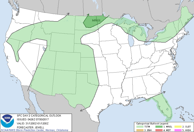
...THERE IS A MARGINAL RISK OF SEVERE THUNDERSTORMS FROM CENTRAL
NORTH DAKOTA INTO NORTHWEST MINNESOTA...
...SUMMARY...
A few strong to severe storms capable of hail and wind are possible
Monday afternoon and evening across North Dakota into northwest
Minnesota.
...Synopsis...
High pressure will remain situated from the middle and upper MS
Valley eastward to the Mid Atlantic, with generally weak flow aloft.
An upper trough will sink southward across south central Canada,
with belt of 30 kt midlevel flow extending into ND and northern MN.
A cold front will also affect the far northern Plains Monday
afternoon and evening, providing a focus for thunderstorms.
Elsewhere, easterly surface winds will maintain moisture into the
southern High Plains, where clusters of thunderstorms are likely
producing mainly rain.
...ND into northwest MN...
Strong heating ahead of a cold front beneath cool temperatures aloft
will lead to a deep layer of steep lapse rates by late afternoon.
Wind profiles will be weak, and dewpoints may barely reach 60 F.
However, scattered storms are expected to form along the front,
multicellular in mode, and capable of marginally severe hail and
localized damaging wind gusts. This threat should be diurnal in
nature, with threat decreasing after sunset.
..Jewell.. 07/30/2017
CLICK TO GET WUUS02 PTSDY2 PRODUCT
NOTE: THE NEXT DAY 2 OUTLOOK IS SCHEDULED BY 1730Z