Minneapolis, MN...St. Paul, MN...Sioux Falls, SD...Duluth, MN...Sioux City, IA...
Probabilistic Graphic
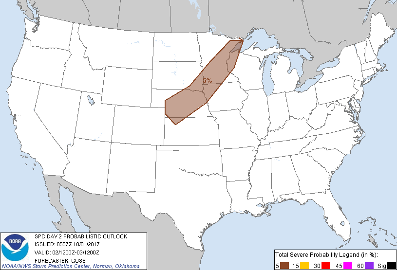
Probability of severe weather within 25 miles of a point. Hatched Area: 10% or greater probability of significant severe within 25 miles of a point.
Day 2 Prob. Risk
Area (sq. mi.)
Area Pop.
Some Larger Population Centers in Risk Area
5 %
121,993
6,067,567
Minneapolis, MN...St. Paul, MN...Sioux Falls, SD...Duluth, MN...Sioux City, IA...
SPC AC 010557
Day 2 Convective Outlook
NWS Storm Prediction Center Norman OK
1257 AM CDT Sun Oct 01 2017
Valid 021200Z - 031200Z
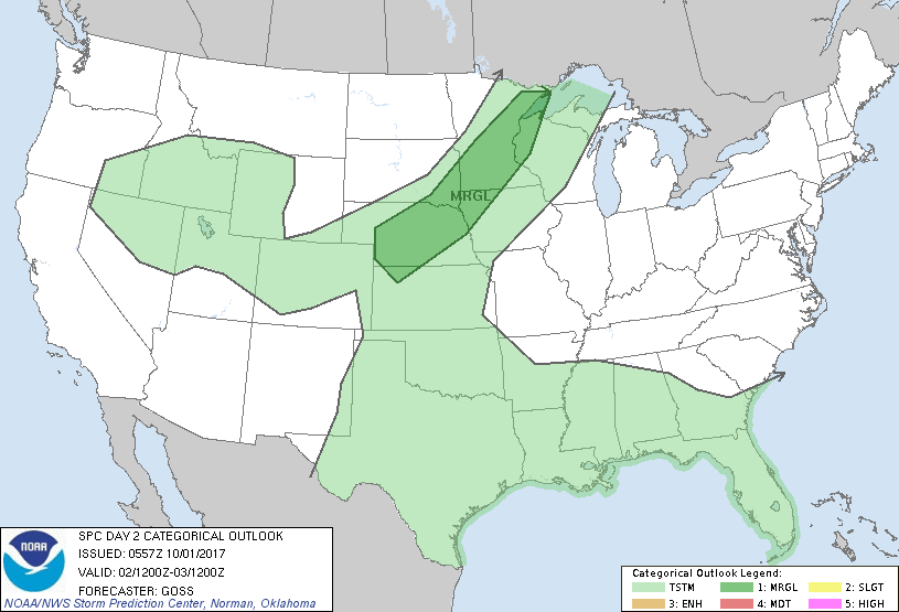
...THERE IS A MARGINAL RISK OF SEVERE THUNDERSTORMS ACROSS POTIONS
OF THE CENTRAL AND NORTH-CENTRAL U.S....
...SUMMARY...
Risk for hail with stronger/locally severe storms is evident across
portions of the central and northern Plains and upper Mississippi
Valley areas Monday.
...Synopsis...
A highly amplified flow field aloft is forecast to persist across
North America Monday, as a large trough/low remains over the western
and north-central portions of the U.S. and a ridge prevails over the
East.
At the surface, a baroclinic zone is forecast to remain
quasi-stationary from the central High Plains north-northeast to the
upper Mississippi Valley area, beneath the weakly rising mid-level
height field progged to resit atop the area. Elsewhere, high
pressure is expected to prevail.
...Central and north-central portions of the country...
Very fast southwesterly/south-southwesterly flow aloft is progged
from the southern Rockies north-northeast to the northern
Plains/upper Great Lakes region, within a tightening/weakly rising
height field sandwiched between the western U.S. ridge and the
eastern trough. With a quasi-stationary surface front lying
south-southwest to north-northeast across the central U.S. and but
overall weak/background large-scale subsidence, it would appear that
the warm sector will remain largely capped, despite afternoon
heating/destabilization.
It continues to appear that the greatest convective risk will remain
to the cool side of the front, in an anafrontal regime where
background subsidence is overcome by isentropically ascending
low-level air. Expect showers and thunderstorms to increase through
the afternoon and evening from southwest Kansas north-northeast into
the upper Mississippi Valley area, to the cool side of the front
where ample elevated instability should exist.
With very fast flow aloft, ample speed shear is expected suggestive
of potential for stronger embedded cells to evolve at times. While
surface-based storm risk appears to remain low at this time, hail
will be possible with these occasionally stronger cells during the
afternoon and evening hours -- warranting continuation of a 5%/MRGL
risk area.
..Goss.. 10/01/2017
CLICK TO GET WUUS02 PTSDY2 PRODUCT
NOTE: THE NEXT DAY 2 OUTLOOK IS SCHEDULED BY 1730Z