SPC AC 221727
Day 2 Convective Outlook
NWS Storm Prediction Center Norman OK
1127 AM CST Fri Dec 22 2017
Valid 231200Z - 241200Z
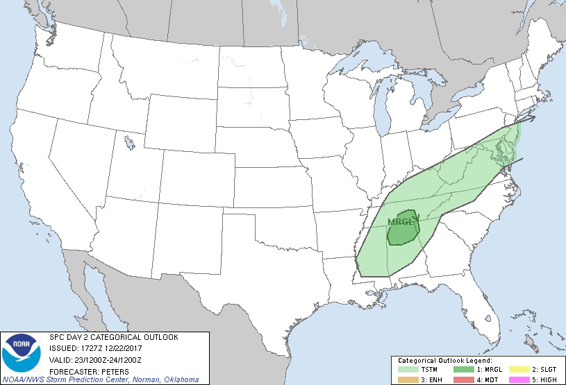
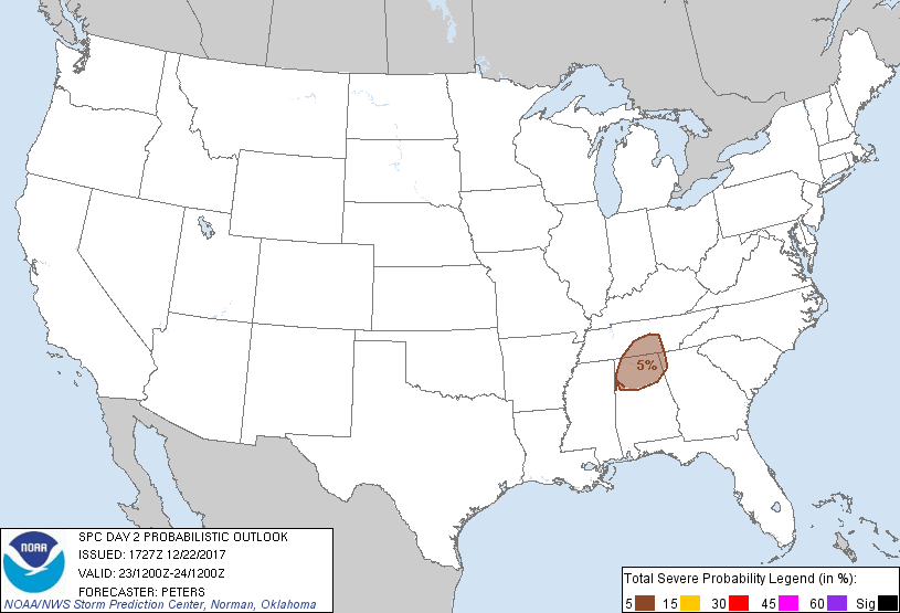
...THERE IS A MARGINAL RISK OF SEVERE THUNDERSTORMS SATURDAY MORNING
ACROSS NORTHERN AL...PART OF MIDDLE TN...INTO FAR NORTHWEST GA...
...SUMMARY...
Isolated damaging winds will be possible Saturday morning across
part of the Tennessee Valley region, as a potential for
thunderstorms spreads from the Mid-South into the Middle Atlantic
region Saturday.
...Synopsis...
A shortwave trough, currently moving through NM per water-vapor
imagery, is expected to de-amplify during Day 2 as it advances
quickly to the east-northeast from the Ozarks to southern New
England by Saturday evening. A surface low located over middle
TN/southeast KY early Saturday will track through the central
Appalachians to NJ by 24/00z, with the trailing cold front advancing
east across the central Gulf coast region into the Mid-Atlantic and
Southeast states.
...Northern AL/middle TN/northwest GA...
Modest midlevel lapse rates (up to 7 C/km), ahead of the progressive
shortwave trough, will spread across the northern extent of a
modified moist plume from the Gulf of Mexico with surface dew points
in the lower 60s into this region. This should support meager
instability (MUCAPE less than 300 J/kg) Saturday morning prior to
the passage of the cold front. A compact area of forcing for ascent
and strong deep-layer winds, attendant to the de-amplifying
shortwave trough, suggest the late Day 1 potential threat for mainly
isolated damaging winds could extend through Saturday morning as a
low-topped convective line along the cold front advances east. The
southern extent of this threat will be limited by the compact nature
of stronger forcing being focused across northern AL, middle TN into
northwest GA, while any storms with north and northeast extent will
be elevated given weaker low-level moisture.
..Peters.. 12/22/2017
CLICK TO GET WUUS02 PTSDY2 PRODUCT
NOTE: THE NEXT DAY 2 OUTLOOK IS SCHEDULED BY 0700Z