Philadelphia, PA...Baltimore, MD...Washington, DC...New Orleans, LA...Virginia Beach, VA...
SPC AC 270711
Day 3 Convective Outlook
NWS Storm Prediction Center Norman OK
0211 AM CDT Sat May 27 2017
Valid 291200Z - 301200Z
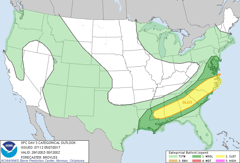
...THERE IS A SLIGHT RISK OF SEVERE THUNDERSTORMS ACROSS PARTS OF
THE GULF COAST STATES...GEORGIA AND CAROLINAS...
...THERE IS A MARGINAL RISK OF SEVERE THUNDERSTORMS OUTSIDE OF THE
SLIGHT RISK AREA ACROSS PARTS OF THE GULF COAST
STATES...GEORGIA...CAROLINAS AND MID-ATLANTIC...
...SUMMARY...
Severe thunderstorms associated with wind damage and hail will be
possible across parts of the Gulf Coast States east-northeastward
into the Carolinas on Monday.
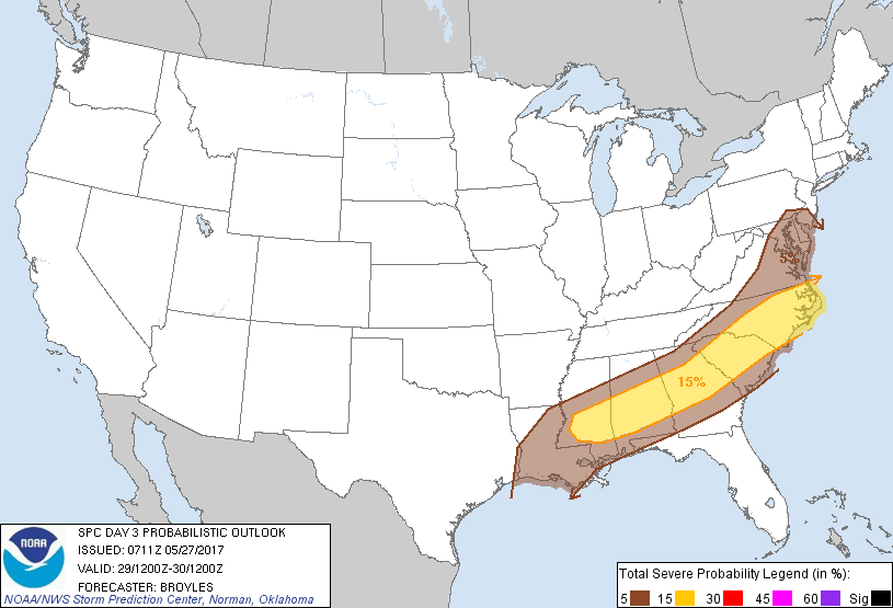
...Gulf Coast States/Georgia/Carolinas/Mid-Atlantic...
An upper-level trough is forecast to move across the Upper Midwest
on Monday as a cold front advances southeastward into the Gulf Coast
States, Georgia and Carolinas. Surface dewpoints ahead of the front
should be in the upper 60s to near 70 F resulting in a corridor of
moderate instability from southern Alabama east-northeastward into
the eastern Carolinas by midday. As the airmass becomes sufficiently
heated by early afternoon, thunderstorm initiation should take place
with the main focus along the front. It appears that several
convective clusters will develop in the mid to late afternoon and
move eastward across the slight risk area.
GFS forecast soundings along the corridor of maximum instability at
21Z on Monday show MLCAPE values generally from 1000 to 2000 J/kg.
Deep-layer shear is forecast to be strongest across North Carolina
where supercells associated with large hail and wind damage will be
possible. An isolated severe threat could also develop northward
into the Mid-Atlantic but weaker instability may keep the severe
threat marginal there. Further southwest into the Gulf Coast States,
0-6 km shear is forecast to be in the 30 to 35 kt range suggesting
that multicell will be the favored mode. In the case that a
multicell line segment or two can organize from southern Alabama
east-northeastward into South Carolina during the late afternoon and
early evening, wind damage would be the primary threat.
..Broyles.. 05/27/2017
CLICK TO GET WUUS03 PTSDY3 PRODUCT
NOTE: THE NEXT DAY 3 OUTLOOK IS SCHEDULED BY 0730Z