SPC AC 230535
Day 3 Convective Outlook
NWS Storm Prediction Center Norman OK
1235 AM CDT Fri Jun 23 2017
Valid 251200Z - 261200Z
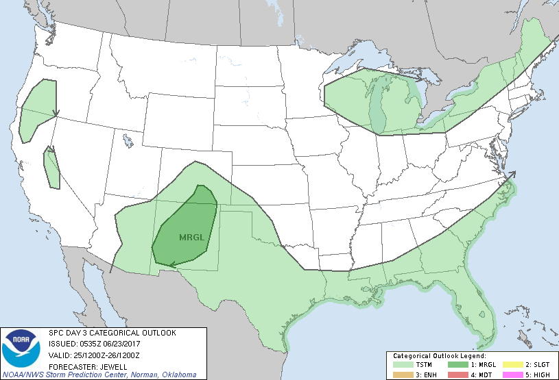
...THERE IS A MARGINAL RISK OF SEVERE THUNDERSTORMS ACROSS NEW
MEXICO INTO SOUTHEAST COLORADO...
...SUMMARY...
General thunderstorms are expected on Sunday mainly from the
southern Rockies across the Gulf Coast and into the Southeast. An
isolated strong storm with hail is possible over New Mexico or
southeast Colorado.
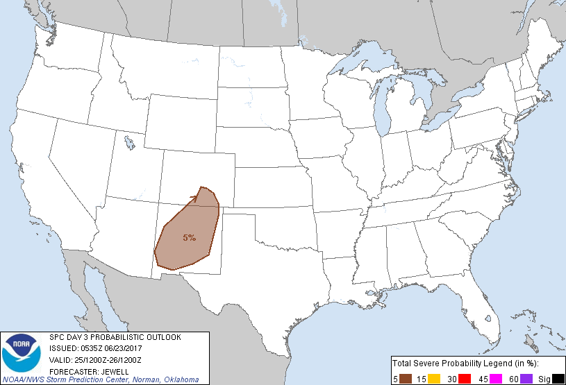
...Synopsis...
A large area of cyclonic flow aloft will remain situated from the
northern Plains eastward to the Atlantic coast, with upper high
centered over northern Baja. This high is forecast to weaken over
time, with afternoon thunderstorms over New Mexico into west Texas.
A surface high will remain over the Plains, with southeasterly winds
helping to maintain 50s dewpoints into New Mexico. A few strong
storms are possible Sunday afternoon in New Mexico and southeast
Colorado, with hail the main risk.
Elsewhere, scattered thunderstorms are expected from the Texas coast
eastward toward the coastal Carolinas, but neither instability nor
shear will support much of a severe threat.
..Jewell.. 06/23/2017
CLICK TO GET WUUS03 PTSDY3 PRODUCT
NOTE: THE NEXT DAY 3 OUTLOOK IS SCHEDULED BY 0730Z