   SPC AC 200819

   Day 3 Convective Outlook
   NWS Storm Prediction Center Norman OK
   0219 AM CST Wed Dec 20 2017

   Valid 221200Z - 231200Z

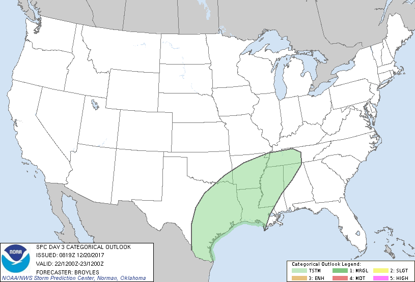
   ...NO SEVERE THUNDERSTORM AREAS FORECAST...

   ...SUMMARY...
   Isolated to scattered thunderstorms will be possible on Friday into
   Friday night from the eastern half of Texas into the lower to mid
   Mississippi Valley.

   ...DISCUSSION...
   An upper-level trough is forecast to move from the southern Rockies
   into west Texas on Friday as a cold front advances quickly southward
   across the southern Plains, Arklatex and mid Mississippi Valley.
   Thunderstorm development may take place along the front during the
   day. Additional convection may develop behind the front from the
   Texas Hill Country into the Arklatex from Friday afternoon into the
   evening. Instability is forecast to be weak across the south-central
   states on Friday which should limit severe threat potential.

   Elsewhere, thunderstorms are not expected across the CONUS Friday or
   Friday night.

   ..Broyles.. 12/20/2017

   CLICK TO GET WUUS03 PTSDY3 PRODUCT

   NOTE: THE NEXT DAY 3 OUTLOOK IS SCHEDULED BY 0830Z
|

