SPC AC 111949
Day 1 Convective Outlook
NWS Storm Prediction Center Norman OK
0149 PM CST Thu Jan 11 2018
Valid 112000Z - 121200Z
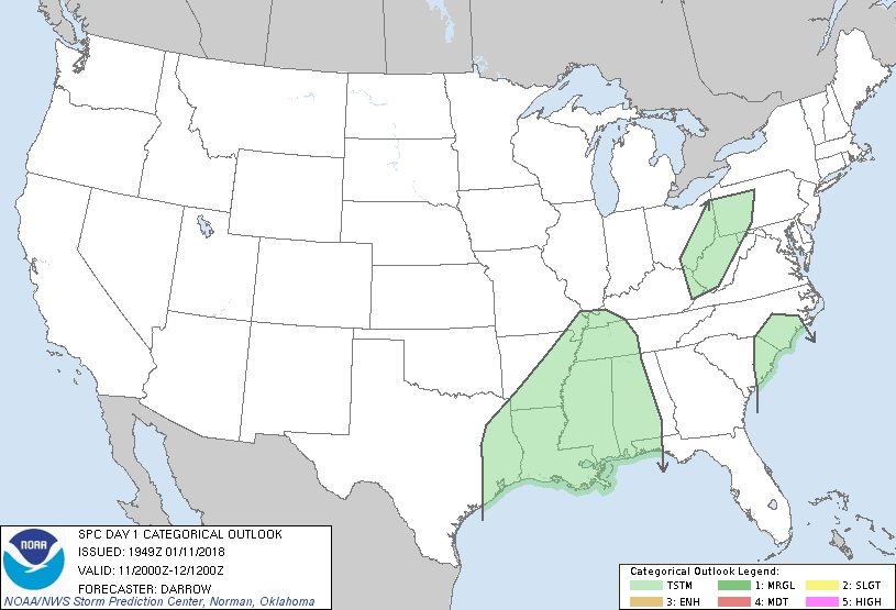
...NO SEVERE THUNDERSTORM AREAS FORECAST...
...SUMMARY...
Isolated to widely scattered thunderstorms are expected across parts
of the Gulf Coast and lower Mississippi Valley this afternoon and
tonight. Elsewhere, isolated thunderstorms will be possible across
parts of the upper Ohio Valley and Carolinas.
...Discussion...
Have lowered thunder probabilities west of the cold front across
southeast TX. Frontal convection has organized along the wind shift
and this activity is advancing toward the lower Sabine River Valley.
Earlier thoughts regarding thunderstorms and low severe
probabilities continue.
..Darrow.. 01/11/2018
.PREV DISCUSSION... /ISSUED 1014 AM CST Thu Jan 11 2018/
...TX/LA/MS...
A large upper trough is tracking eastward across the Plains states,
with a strong cold front surging southeastward across OK/TX. This
front will move into the ArkLaTex region this afternoon, and is
likely to provide the focus for a line of showers and thunderstorms.
Forecast soundings ahead of the activity show relatively weak
thermodynamic parameters are expected, with CAPE values below 500
J/kg and weak mid-level lapse rates. Low and mid-level winds fields
will also be somewhat weak, limiting updraft organization and
maintenance. Gusty winds are expected along the leading edge of the
convection this afternoon/evening. However, the risk of severe wind
gusts appears low, so will not add a MRGL risk area at this time.
Elsewhere, showers with isolated thunderstorms will be possible
along the front into the Mid MS Valley this afternoon and evening,
in the upper OH Valley this evening and tonight, and in a plume of
weakly unstable air later tonight over parts of SC/NC. Severe
storms are not expected in these areas.
CLICK TO GET WUUS01 PTSDY1 PRODUCT
NOTE: THE NEXT DAY 1 OUTLOOK IS SCHEDULED BY 0100Z
|