SPC AC 041257
Day 1 Convective Outlook
NWS Storm Prediction Center Norman OK
0657 AM CST Sun Feb 04 2018
Valid 041300Z - 051200Z
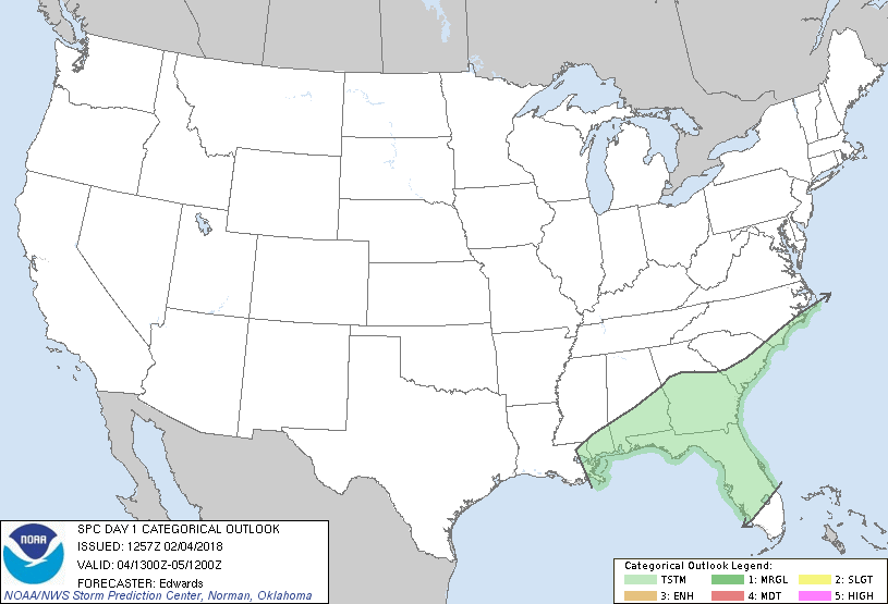
...NO SEVERE THUNDERSTORM AREAS FORECAST...
...SUMMARY...
Thunderstorms are expected across portions of the Southeast today.
...Synopsis...
In mid/upper levels, a mean trough will remain over the eastern
states, traversed by several shortwaves. The most pronounced of
those shortwaves will include a trough -- now evident in moisture-
channel imagery over portions of MN/SD -- forecast to pivot
southeastward/eastward over the Great Lakes, Ohio Valley, and
northern/central Appalachians through the period. Meanwhile,
cyclonic flow is expected to extend across most of the contiguous
U.S. as a strong shortwave trough -- now located offshore from BC --
moves past the mean ridge position and southeastward over the
Pacific Northwest.
At the surface, a synoptic cold front influenced by the northern-
stream perturbation was analyzed from lower MI across MO to northern
OK. By 00Z, this front should reach central OH, western/mid TN,
central TX and northeastern NM, before merging with or becoming
indistinguishable in the building anticyclone behind the front
described next. A surface trough was analyzed from middle TN across
MS to southeastern LA, with some baroclinicity evident closer to the
Gulf. Frontogenesis is forecast as a low forms over AL and moves
northeastward toward the VA Tidewater region by 00Z, with the front
extending southwestward across the Carolinas, GA and western/central
FL Panhandle.
...Southeast...
Multiple bands of low-level convergence, both near and ahead of the
eastern frontal zone, are expected to support thunderstorm potential
shifting generally eastward across this region today. Isolated to
scattered thunderstorms are expected in a broad zone of elevated
warm advection and moisture transport, as parcels are lifted
isentropically to an LFC, with episodic banding and clustering of
storm modes. Activity largely will be elevated above relatively
stable near-surface conditions, amidst modest midlevel lapse rates.
The greatest depth/coverage of thunderstorms should remain over the
Gulf, as well as late in the period over the Atlantic's Gulf Stream
waters. So will the most consistent potential for surface-based
convection -- especially across the northern Loop Current where
ocean-air thermal fluxes will be maximized. With eastward extent
from there into the FL peninsula, expect cooling of the boundary
layer -- gradual at first across cooler shelf waters then stronger
amidst lower antecedent/overland boundary-layer theta-e. That
storm-relative thermal transition should be deleterious to
maintenance of optimal inflow parcels inland, though a strong gust
or two cannot be ruled out along the southernmost Panhandle coast
near AAF or the northern part of the FL west coast. Overall,
convection will outrun near-surface inflow regimes and severe
potential appears too isolated/conditional to warrant a categorical
severe-risk area at this time.
..Edwards.. 02/04/2018
CLICK TO GET WUUS01 PTSDY1 PRODUCT
NOTE: THE NEXT DAY 1 OUTLOOK IS SCHEDULED BY 1630Z
|