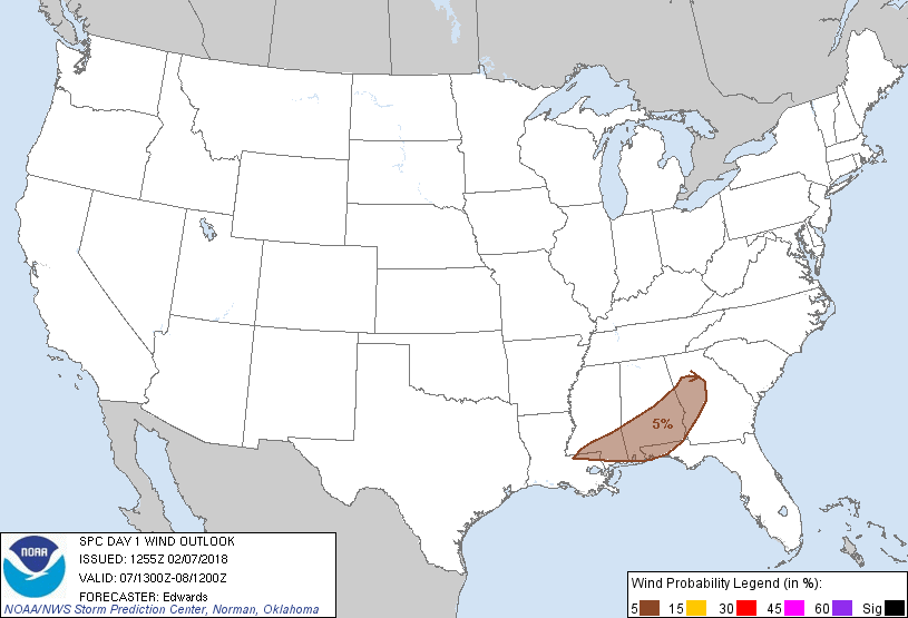
Probability of damaging thunderstorm winds or wind gusts of 50 knots or higher within 25 miles of a point. Hatched Area: 10% of greater probability of wind gusts 65 knots or greater within 25 miles of a point.
Probability of hail 1" or larger within 25 miles of a point. Hatched Area: 10% or greater probability of hail 2" or larger within 25 miles of a point.
Day 1 Hail Risk
Area (sq. mi.)
Area Pop.
Some Larger Population Centers in Risk Area
No Risk Areas Forecast
SPC AC 071255
Day 1 Convective Outlook
NWS Storm Prediction Center Norman OK
0655 AM CST Wed Feb 07 2018
Valid 071300Z - 081200Z
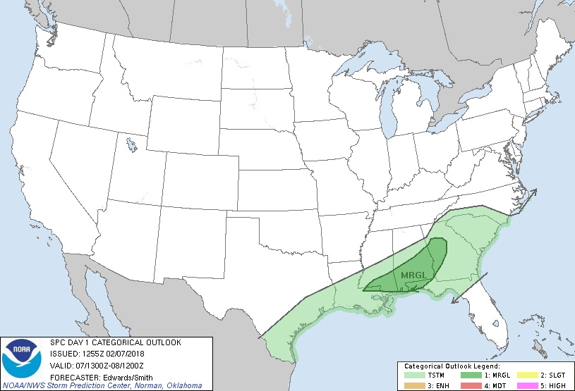
...THERE IS A MARGINAL RISK OF SEVERE THUNDERSTORMS OVER PARTS OF
THE CENTRAL TO EASTERN GULF COASTAL REGION...
...SUMMARY...
Thunderstorms may produce isolated severe weather today over parts
of the central to eastern Gulf coastal region.
...Synopsis...
The mid/upper-level longwave trough over eastern North America will
maintain broadly cyclonic flow over most of the U.S. east of the
Rockies. A well-defined/embedded shortwave trough -- now evident in
moisture channel imagery over southeastern NM and far west TX --
will move eastward across much of TX and begin to elongate/weaken
through 00Z. By 12Z, the associated 500-mb vorticity field will
have stretched considerably, extending from northern GA to the TX
coastal plain, leaving the attendant shortwave trough in an even
more weakened/positively tilted state.
At the surface, an elongated area of low pressure was evident along
a cold-frontal zone from WV to eastern KY, with the cold front
extending southwestward over central MS, southwestern LA and deep
south TX. By 00Z the consolidated surface low should reach southern
New England, with cold front to the western carolinas, western FL
Panhandle and north-central/western Gulf. By 12Z, the front should
clear all the mainland except for central/southern FL. A diffuse
marine/warm front, representing the equatorward part of the
transition from a well-modified Gulf boundary layer to a residual,
partly modified, continental/polar air mass, was analyzed from
south-central AL across the western FL Panhandle and eastern Gulf to
south FL. This baroclinic zone will move slowly east-northeastward
over southern/eastern AL, southwestern GA and the western FL
Panhandle today, before being overtaken by the cold front and the
prefrontal part of a convective band.
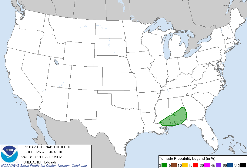
...Central/eastern Gulf coastal region...
Scattered thunderstorms should continue to shift eastward across the
region through the daytime hours, in a generally southwest/
northeast-oriented band. This convection (especially the
middle-southern part) may offer isolated damaging gusts and the
potential for a tornado. The outlook has been adjusted southward in
deference both to ongoing convective trends (timed faster than in
earlier progs) and some potential for isolated daytime severe in the
warm sector, nearer to the coast.
The ongoing band of convection is located close to the cold front
over much of its MS/LA extent, and is elevated ahead of the cold
front and north of the marine front farther northeast. The
foregoing warm sector is expected to destabilize diurnally, from a
combination of warm advection and erratic insolation beneath broken
cloud cover, with greater buoyancy just inland from the coast.
Modified forecast soundings suggest low-level moisture will offset
modest lapse rates aloft enough for relatively uninhibited, surface-
based buoyancy in the warm sector. MLCAPE should rise into the
500-1000 J/kg range generally south of the MGM-CSG corridor, ahead
of the cold front, and dropping off considerably farther north due
to thicker cloud cover, lower antecedent theta-e along/north of the
marine front, and less time for advective warming. Deep shear will
increase northward toward more stable air, with 40-50-kt effective-
shear magnitudes common near the coast. In the warm sector,
effective SRH should peak this morning, increasing northeastward
across the diffuse marine front, but also, slowly decreasing with
time. Still, a few supercells are possible, either embedded in the
main band or forming gradually over low-level convergence lines in
the near-coastal warm sector.
Continued veering of low-level flow, as the surface cyclone and
related isallobaric forcing eject away from the region -- will lead
to reduced convergence and low-level shear from late afternoon into
evening along the front, as well as in the warm sector. That
process also will overlap with the onset of diabatic surface cooling
as boundary-layer lapse rates decline from their afternoon peak.
Convective coverage and remaining severe potential accordingly
should diminish markedly during that time frame.
..Edwards/Smith.. 02/07/2018
CLICK TO GET WUUS01 PTSDY1 PRODUCT
NOTE: THE NEXT DAY 1 OUTLOOK IS SCHEDULED BY 1630Z