Probability of a tornado within 25 miles of a point. Hatched Area: 10% or greater probability of EF2 - EF5 tornadoes within 25 miles of a point.
Day 1 Tornado Risk
Area (sq. mi.)
Area Pop.
Some Larger Population Centers in Risk Area
No Risk Areas Forecast
Probabilistic Damaging Wind Graphic
Probability of damaging thunderstorm winds or wind gusts of 50 knots or higher within 25 miles of a point. Hatched Area: 10% of greater probability of wind gusts 65 knots or greater within 25 miles of a point.
Day 1 Wind Risk
Area (sq. mi.)
Area Pop.
Some Larger Population Centers in Risk Area
No Risk Areas Forecast
Probabilistic Large Hail Graphic
Probability of hail 1" or larger within 25 miles of a point. Hatched Area: 10% or greater probability of hail 2" or larger within 25 miles of a point.
Day 1 Hail Risk
Area (sq. mi.)
Area Pop.
Some Larger Population Centers in Risk Area
No Risk Areas Forecast
SPC AC 091932
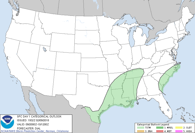
Day 1 Convective Outlook
NWS Storm Prediction Center Norman OK
0132 PM CST Fri Feb 09 2018
Valid 092000Z - 101200Z
...NO SEVERE THUNDERSTORM AREAS FORECAST...
...SUMMARY...
Thunderstorms are expected to increase in coverage mainly tonight
through early Saturday from southeast Texas to the lower Mississippi
Valley. A few thunderstorms may also occur along the south Atlantic
Coast this afternoon into tonight.
...Discussion...
Previous forecast appears on track with only minor adjustments
needed with this update.
..Dial.. 02/09/2018
.PREV DISCUSSION... /ISSUED 1016 AM CST Fri Feb 09 2018/
...Coastal GA/Carolinas...
Isolated thunder may develop in association with a minor mid-level
perturbation and weak low-level warm advection regime that shifts
towards the South Atlantic Coast through tonight. 12Z Jacksonville
sounding sampled a sliver of MUCAPE near 200 J/kg. The bulk of the
convective activity will likely develop offshore.
...Southeast TX to Lower MS Valley...
A broad swath of 25-40 kt 850-mb southwesterlies will foster
moderate low-level warm advection atop a warm front slowly advancing
north from the northern Gulf tonight. This moistening will result in
increasing, but still weak MUCAPE amid modest mid-level lapse rates.
Showers and embedded storms will increase tonight into early
Saturday. Moderate speed shear through thinly buoyant parcels may
yield effective values approaching 30 kt. While weak mid-level
rotation in a cell or two is possible, the instability/hodograph
combination appears too small amid a near-surface stable layer to
warrant severe probabilities.
CLICK TO GET WUUS01 PTSDY1 PRODUCT
NOTE: THE NEXT DAY 1 OUTLOOK IS SCHEDULED BY 0100Z