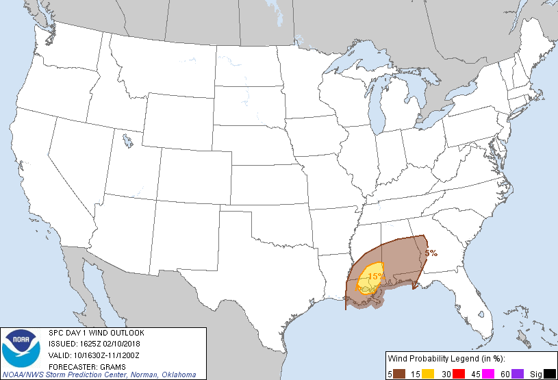
Probability of damaging thunderstorm winds or wind gusts of 50 knots or higher within 25 miles of a point. Hatched Area: 10% of greater probability of wind gusts 65 knots or greater within 25 miles of a point.
Day 1 Wind Risk
Area (sq. mi.)
Area Pop.
Some Larger Population Centers in Risk Area
15 %
15,774
2,038,492
New Orleans, LA...Metairie, LA...Gulfport, MS...Kenner, LA...Hattiesburg, MS...
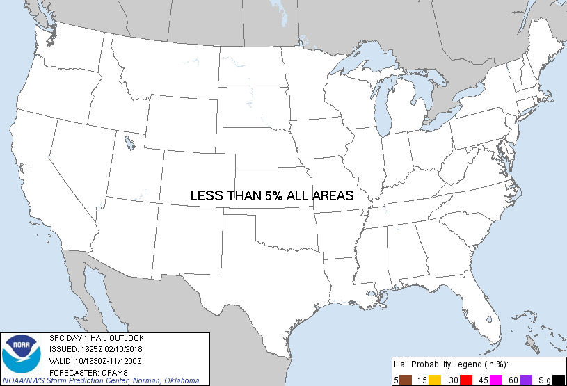
Probability of hail 1" or larger within 25 miles of a point. Hatched Area: 10% or greater probability of hail 2" or larger within 25 miles of a point.
Day 1 Hail Risk
Area (sq. mi.)
Area Pop.
Some Larger Population Centers in Risk Area
No Risk Areas Forecast
SPC AC 101625
Day 1 Convective Outlook
NWS Storm Prediction Center Norman OK
1025 AM CST Sat Feb 10 2018
Valid 101630Z - 111200Z
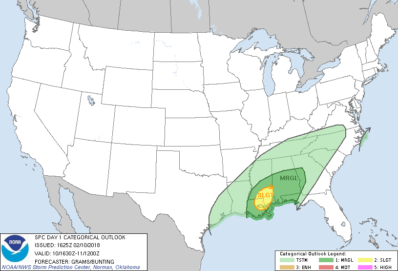
...THERE IS A SLIGHT RISK OF SEVERE THUNDERSTORMS SOUTHEAST MS/LA...
...THERE IS A MARGINAL RISK OF SEVERE THUNDERSTORMS DEEP SOUTH AND
CENTRAL GULF COAST STATES...
...SUMMARY...
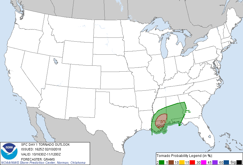
A couple tornadoes and isolated damaging winds are possible across
parts of the Deep South and Central Gulf Coast States through
tonight.
...Deep South and Central Gulf Coast States...
Primary change was to upgrade to a Slight risk for tornado and wind
across parts of southeast MS/LA, centered on late afternoon and
early evening.
Thinning of cloud coverage is underway across southeast LA into
southern MS in between a lead convective band near/south of Mobile
Bay and a larger convective plume across the Sabine Valley. This
modest diabatic heating in conjunction with surface dew points
increasing to 65-70 deg F should yield a corridor of SBCAPE between
500-1000 J/kg by late afternoon. Guidance is consistent in
suggesting a southern-stream upper-level jet will overspread the
northwest Gulf by 00Z, placing the Lower MS Valley in the left-exit
region. This will result in strengthening low- and mid-level
southwest flow, conditionally supportive of a couple supercells with
accompanying risks for tornado and damaging wind. The 12Z NAM-Nest
and 14-15Z HRRR runs simulate this potential scenario between about
22-03Z with other CAMs depicting weaker or minimal convection in the
corridor of best CAPE/shear combination. Have introduced a Slight
risk across the most conditionally favorable region.
Along the central Gulf Coast, warm advection atop the marine front
should result in renewed storm development early Sunday. Convective
mode within this region should predominately favor clusters.
Low-level winds should be weakening as the southern-stream mid-level
impulse accelerates towards the Mid-Atlantic States. Isolated
damaging winds should be the primary hazard within this region
overnight.
..Grams/Bunting.. 02/10/2018
CLICK TO GET WUUS01 PTSDY1 PRODUCT
NOTE: THE NEXT DAY 1 OUTLOOK IS SCHEDULED BY 2000Z