Probability of a tornado within 25 miles of a point. Hatched Area: 10% or greater probability of EF2 - EF5 tornadoes within 25 miles of a point.
Day 1 Tornado Risk
Area (sq. mi.)
Area Pop.
Some Larger Population Centers in Risk Area
No Risk Areas Forecast
Probabilistic Damaging Wind Graphic
Probability of damaging thunderstorm winds or wind gusts of 50 knots or higher within 25 miles of a point. Hatched Area: 10% of greater probability of wind gusts 65 knots or greater within 25 miles of a point.
Day 1 Wind Risk
Area (sq. mi.)
Area Pop.
Some Larger Population Centers in Risk Area
No Risk Areas Forecast
Probabilistic Large Hail Graphic
Probability of hail 1" or larger within 25 miles of a point. Hatched Area: 10% or greater probability of hail 2" or larger within 25 miles of a point.
Day 1 Hail Risk
Area (sq. mi.)
Area Pop.
Some Larger Population Centers in Risk Area
No Risk Areas Forecast
SPC AC 100052
Day 1 Convective Outlook
NWS Storm Prediction Center Norman OK
0652 PM CST Fri Mar 09 2018
Valid 100100Z - 101200Z
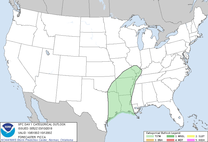
...NO SEVERE THUNDERSTORM AREAS FORECAST...
...SUMMARY...
Isolated thunderstorms will remain possible across parts of the
Ozarks and mid Mississippi Valley into tonight. Thunderstorms are
also expected to develop from the Arklatex southward to the Gulf
Coast overnight.
...Texas Coast...
Within the southern-stream mid/upper jet, a subtle shortwave impulse
will cross southern/central Texas overnight. Coupled with
north/northwestward low-level moisture return, increasing forcing
for ascent will promote thunderstorm development near the mid/upper
Texas coast late tonight. While ample effective shear will exist for
updraft organization across the region, higher boundary-layer
theta-e will remain just offshore, likely keeping stronger
thunderstorms from developing inland overnight. Therefore, no severe
probabilities have been added with this outlook.
..Picca.. 03/10/2018
CLICK TO GET WUUS01 PTSDY1 PRODUCT
NOTE: THE NEXT DAY 1 OUTLOOK IS SCHEDULED BY 0600Z