SPC AC 300046
Day 1 Convective Outlook
NWS Storm Prediction Center Norman OK
0746 PM CDT Thu Mar 29 2018
Valid 300100Z - 301200Z
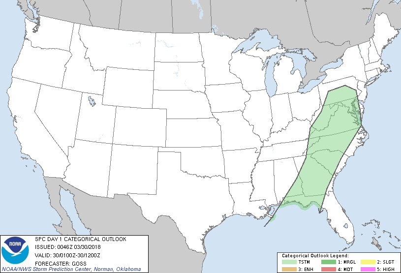
...NO SEVERE THUNDERSTORM AREAS FORECAST...
...SUMMARY...
Appreciable severe risk has diminished, with severe weather unlikely
overnight.
...Discussion...
Evening RAOBs confirm an overall lack of CAPE depicted by objective
analyses this evening, and suggested by the general decrease in
lightning observed over the past hour.
While the deep-layer wind field remains quite strong, the lack of
available instability suggests that storms will continue to
gradually weaken over the next several hours. By the end of the
period, the band of showers -- and possibly some sporadic lightning
-- should extend from the mid-Atlantic region to southeast Georgia
and eastern portions of the Florida panhandle and the adjacent
northern Florida Peninsula, with the cold front in lee of the
Appalachians.
Elsewhere, lightning has ceased over the central High Plains, with
showers continuing to diminish. Additional/appreciable lightning is
not expected.
..Goss.. 03/30/2018
CLICK TO GET WUUS01 PTSDY1 PRODUCT
NOTE: THE NEXT DAY 1 OUTLOOK IS SCHEDULED BY 0600Z
|