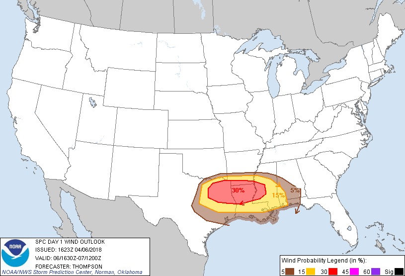
Probability of damaging thunderstorm winds or wind gusts of 50 knots or higher within 25 miles of a point. Hatched Area: 10% of greater probability of wind gusts 65 knots or greater within 25 miles of a point.
Houston, TX...Austin, TX...Baton Rouge, LA...Little Rock, AR...Jackson, MS...
SPC AC 061623
Day 1 Convective Outlook
NWS Storm Prediction Center Norman OK
1123 AM CDT Fri Apr 06 2018
Valid 061630Z - 071200Z
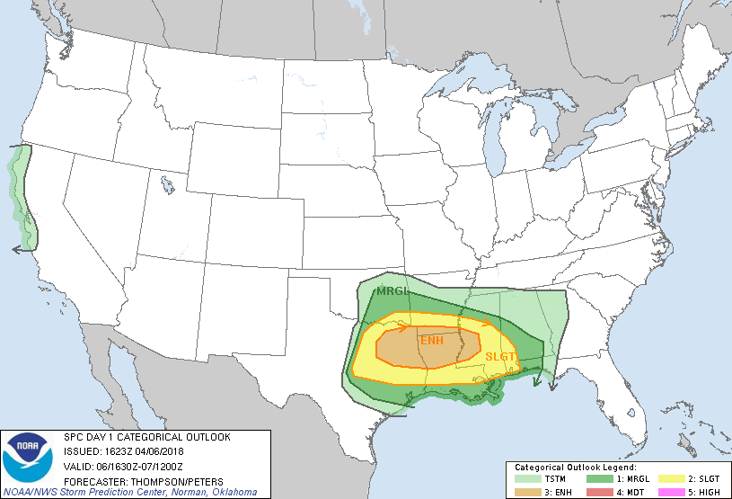
...THERE IS AN ENHANCED RISK OF SEVERE THUNDERSTORMS THIS AFTERNOON
THROUGH EARLY TONIGHT FROM NORTHEAST TX TO WEST CENTRAL MS...
...THERE IS A SLIGHT RISK OF SEVERE THUNDERSTORMS CENTRAL AND NORTH
TX TO THE LOWER MS VALLEY...
...THERE IS A MARGINAL RISK OF SEVERE THUNDERSTORMS SURROUNDING THE
SLIGHT RISK AREA...
...SUMMARY...
Severe thunderstorms with damaging winds, occasional hail, and a few
tornadoes, are expected this afternoon through tonight from north
and central Texas eastward to the lower Mississippi Valley.
...Southern Plains to the lower MS Valley through tonight...
A remnant lee cyclone now near Wichita Falls will move
east-southeastward toward northeast TX and northwest LA by this
evening, in advance of a series of low-amplitude mid-upper speed
maxima. The moist warm sector, characterized by boundary-layer
dewpoints of 65-70 F, will continue to spread northward to a
baroclinic zone from the Red River valley of TX/OK across southern
AR/northern LA through the afternoon. This southern baroclinic zone
will be overtaken from northwest to southeast by a surge of arctic
air now moving into the I-44 corridor, and this consolidated cold
front will continue southeastward to south central/southeast TX and
the lower MS Valley by the end of the period.
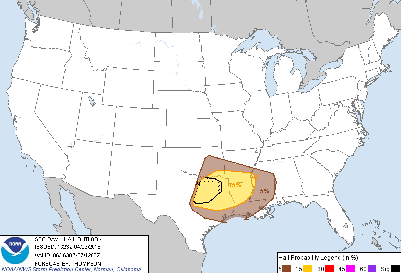
Regional 12z soundings revealed an elevated mixed layer atop the
moistening boundary layer across TX. Daytime heating will boost
MLCAPE to in excess of 3000 J/kg across TX, and closer to 1000-1500
J/kg as far as west central MS by mid afternoon as the moisture
spreads northward. A few surface-based storms may form by this
evening near the dryline-cold front triple point in TX, as well as
southward along the dryline into central TX. Here, the storm
environment will favor supercells capable of producing isolated very
large hail, especially with any storms that can remain discrete.
Otherwise, the main convective evolution is expected to be a gradual
transition of the ongoing elevated convection across eastern OK/AR
into surface-based convection along the consolidating cold front by
mid afternoon. These frontal storms will grow upscale fairly
quickly into a squall line that will then surge southeastward this
afternoon through tonight with the cold front. The cap will be
weaker with eastward extent from northeast TX across LA, and some
convection could develop in the warm sector this afternoon.
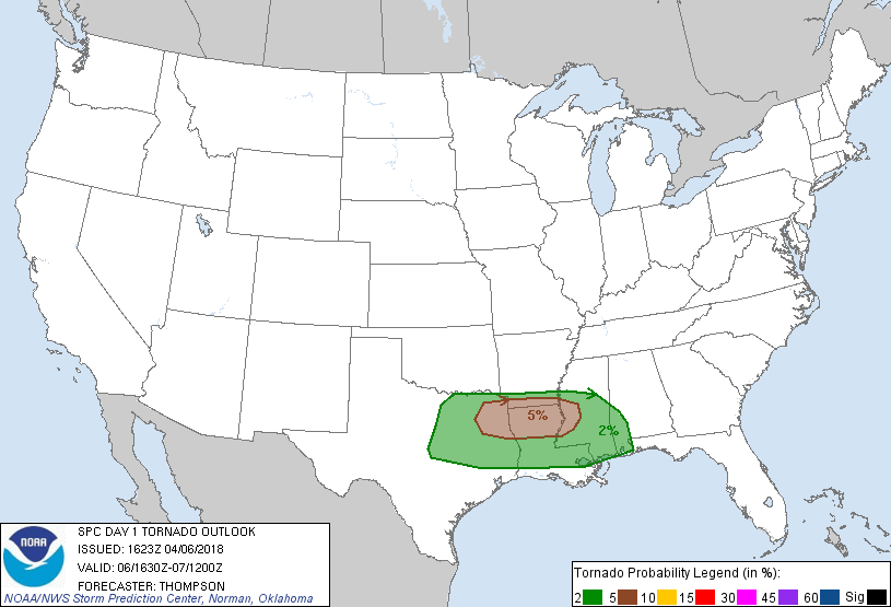
Low-level shear/hodograph curvature will favor supercells with some
conditional tornado threat, though there is uncertainty regarding
the duration of any semi-discrete storms. The more probable
scenario will be for a couple of tornadoes with embedded supercells
and/or QLCS mesovortices, along with damaging winds and isolated
large hail this afternoon through early tonight.
Buoyancy will slowly weaken overnight, and the convection should
likewise weaken. However, there will still be some threat for at
least isolated damaging winds as far south as the I-10 corridor from
southeast TX eastward to southern MS through early Saturday morning.
..Thompson/Peters.. 04/06/2018
CLICK TO GET WUUS01 PTSDY1 PRODUCT
NOTE: THE NEXT DAY 1 OUTLOOK IS SCHEDULED BY 2000Z