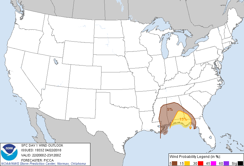
Probability of damaging thunderstorm winds or wind gusts of 50 knots or higher within 25 miles of a point. Hatched Area: 10% of greater probability of wind gusts 65 knots or greater within 25 miles of a point.
Day 1 Wind Risk
Area (sq. mi.)
Area Pop.
Some Larger Population Centers in Risk Area
15 %
27,126
2,031,321
Tallahassee, FL...Dothan, AL...Pensacola, FL...Panama City, FL...Ferry Pass, FL...
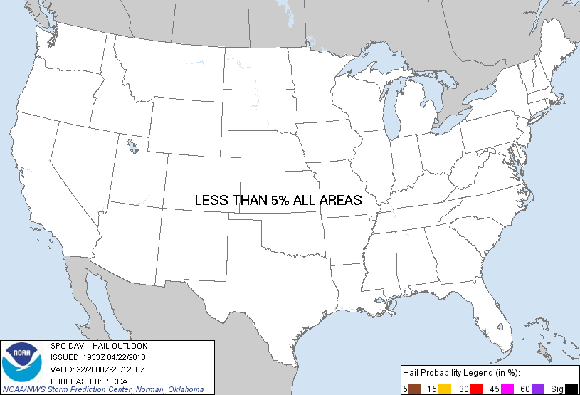
Probability of hail 1" or larger within 25 miles of a point. Hatched Area: 10% or greater probability of hail 2" or larger within 25 miles of a point.
Day 1 Hail Risk
Area (sq. mi.)
Area Pop.
Some Larger Population Centers in Risk Area
No Risk Areas Forecast
SPC AC 221933
Day 1 Convective Outlook
NWS Storm Prediction Center Norman OK
0233 PM CDT Sun Apr 22 2018
Valid 222000Z - 231200Z
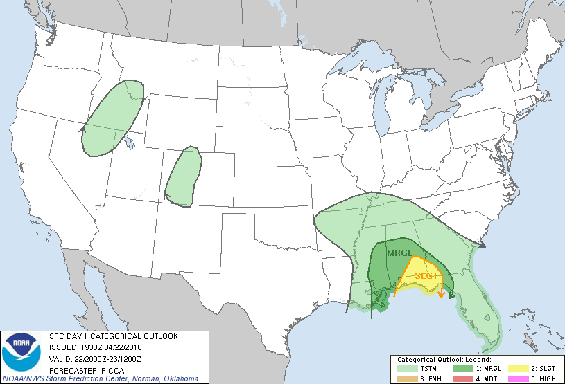
...THERE IS A SLIGHT RISK OF SEVERE THUNDERSTORMS ACROSS PORTIONS OF
THE CENTRAL/EASTERN GULF COAST...
...THERE IS A MARGINAL RISK OF SEVERE THUNDERSTORMS ACROSS PORTIONS
OF THE SOUTHEAST...
...SUMMARY...
Isolated severe thunderstorms, capable of damaging winds and a few
tornadoes, are possible across parts of Alabama, the Florida
Panhandle, and southwest Georgia into this evening.
...Discussion...
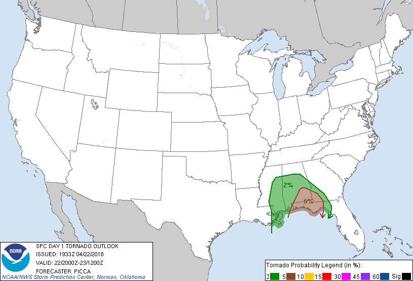
Recent single-radar and MRMS data have displayed an organizational
uptick in shallow supercellular activity across the region. In fact,
a tornadic debris signature was recently observed with a cell over
Crenshaw Co, AL, suggesting some increase in tornado potential is
being realized this afternoon. KEVX data display a wind profile
favorable for the sustenance of low-level mesocyclones, and
boundary-layer moisture is certainly adequate for tornadogenesis
with these isolated cells, as well as new development moving onshore
from the northern Gulf. Therefore, a slight risk has been introduced
from southeast Alabama to southwest Georgia and the Florida
Panhandle.
..Picca.. 04/22/2018
.PREV DISCUSSION... /ISSUED 1111 AM CDT Sun Apr 22 2018/
...Central Gulf Coast...
Water vapor imagery shows a well-defined shortwave trough rotating
eastward across LA. A surface low associated with this feature will
occlude and lift northward across MS today. Widespread clouds and
precipitation in the warm sector of the low will limit
destabilization and the resultant overall severe threat. Therefore,
will maintain the ongoing MRGL risk category. However, local VAD
profiles and forecast soundings show substantial low-level vertical
shear over the central Gulf Coast states. Radar signatures this
morning have shown occasional rotating cells over southeast LA, and
this general trend may continue through the day. Isolated cells
will be capable of brief tornadoes or locally gusty/damaging wind
gusts throughout the day, but the isolated and brief nature of the
threat does not warrant an upgrade at this time.
CLICK TO GET WUUS01 PTSDY1 PRODUCT
NOTE: THE NEXT DAY 1 OUTLOOK IS SCHEDULED BY 0100Z