SPC AC 050535
Day 2 Convective Outlook
NWS Storm Prediction Center Norman OK
1135 PM CST Sun Feb 04 2018
Valid 061200Z - 071200Z
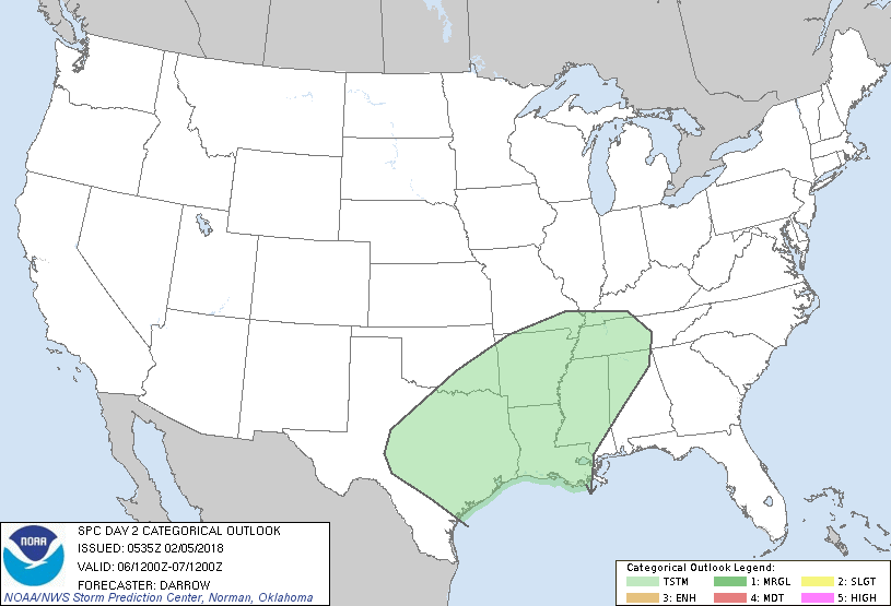
...NO SEVERE THUNDERSTORM AREAS FORECAST...
...SUMMARY...
Thunderstorms are expected to develop along a corridor from central
Texas to middle Tennessee.
...Discussion...
Reinforcing surge of continental air will settle into the coastal
plain of TX Monday where a coastal front is expected to evolve then
lift north during the day2 period. Latest trends suggest moisture
will be a bit slower to return to southeast TX than earlier guidance
forecast. Even so, seasonally high PW will advance atop a cold
boundary layer from central TX into western TN aided in large part
by an increasing, but veered, LLJ. Forecast soundings across TX
suggest relatively steep mid-level lapse rates (on the order of 7
C/km) will advect toward the Arklatex which should enhance buoyancy
for elevated post-frontal convection. MUCAPE may approach 800-900
J/kg near the frontal corridor and robust updrafts could certainly
develop within this ribbon of warm advection. There is some concern,
given the forecast lapse rates, that hail could develop within the
strongest updrafts, especially from central TX into southern AR.
However current thinking is the majority of storms will struggle to
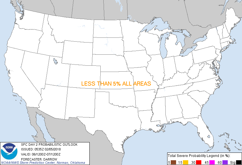
produce hail in excess of .75". Will not introduce 5% severe probs
at this time due to the expected marginality in hail size.
..Darrow.. 02/05/2018
CLICK TO GET WUUS02 PTSDY2 PRODUCT
NOTE: THE NEXT DAY 2 OUTLOOK IS SCHEDULED BY 1730Z
|