   SPC AC 010600

   Day 3 Convective Outlook
   NWS Storm Prediction Center Norman OK
   1200 AM CST Mon Jan 01 2018

   Valid 031200Z - 041200Z

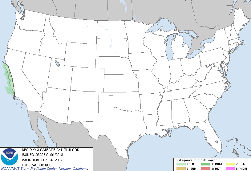
   ...NO SEVERE THUNDERSTORM AREAS FORECAST...

   ...SUMMARY...
   Some thunderstorm activity is possible near central California
   coastal areas late Wednesday afternoon and evening, but the risk for
   severe storms appears negligible.

   ...Discussion...
   Mid/upper flow will remain amplified across North America through
   this period.  In association with one significant short wave within
   larger-scale troughing across the East, models continue to indicate
   that strong cyclogenesis will take place over the western Atlantic,
   near/north of the Bahamas northeastward toward the Canadian
   Maritimes.  In the wake of this feature, generally cold and stable
   conditions likely will continue across most areas east of the
   Rockies.

   Meanwhile, large-scale ridging, within perhaps a couple of
   increasingly in-phase belts of westerlies, is expected to persist
   across much of western North America.  However, it does appear that
   the remnants of a southern stream closed low may accelerate
   north/northeastward into portions of central and northern California
   late Wednesday into Wednesday night.  While the mid-level cold pool
   with this feature may not be particularly cold (warmer than -20C),
   models suggest that an influx of moisture from the lower latitudes
   could perhaps still contribute to mid-level destabilization
   supportive of convection capable of producing lightning, into at
   least the vicinity of central California coastal areas.

   ..Kerr.. 01/01/2018

   CLICK TO GET WUUS03 PTSDY3 PRODUCT

   NOTE: THE NEXT DAY 3 OUTLOOK IS SCHEDULED BY 0830Z
|

