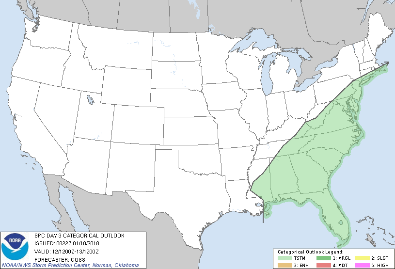
   SPC AC 100822

   Day 3 Convective Outlook
   NWS Storm Prediction Center Norman OK
   0222 AM CST Wed Jan 10 2018

   Valid 121200Z - 131200Z

   ...NO SEVERE THUNDERSTORM AREAS FORECAST...

   ...SUMMARY...
   Showers and local/embedded thunderstorms will be possible from the
   central Gulf Coast region across the Eastern Seaboard on Friday.

   ...Synopsis...
   Slow eastward progression -- and overall expansion -- of the
   large-scale central and eastern U.S. trough is expected this period,
   while ridging remains centered along the West Coast.  As a
   shorter-wavelength trough -- embedded in the larger-scale cyclonic
   flow and initially residing over the lower Mississippi Valley --
   shifts northeastward toward the central Appalachians region, an
   associated surface cyclone is progged to shift from the central Gulf
   Coast states to the Mid-Atlantic vicinity through the period.  The
   cold front trailing south of this low will likewise advance
   eastward, and should clear both the Atlantic and Gulf coasts by
   Saturday morning.

   ...Central Gulf Coast states to the East Coast...
   Showers and occasional embedded thunderstorms are forecast to spread
   across the area Friday, ahead of a surface frontal system and
   associated upper trough.  With the warm sector likely to be
   characterized by a still-cool/stable boundary layer beneath weak
   mid-level lapse rates, the anticipated lack of CAPE should hinder
   overall convective activity.  As such, despite amply strong flow
   aloft and an otherwise favorable synoptic setup, severe risk appears
   at this time likely to remain minimal.

   ..Goss.. 01/10/2018

   CLICK TO GET WUUS03 PTSDY3 PRODUCT

   NOTE: THE NEXT DAY 3 OUTLOOK IS SCHEDULED BY 0830Z
|

