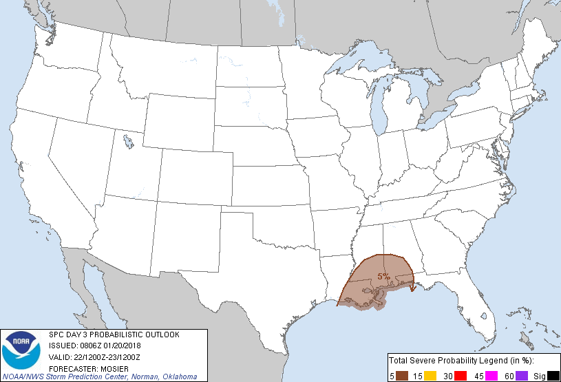
New Orleans, LA...Baton Rouge, LA...Mobile, AL...Jackson, MS...Metairie, LA...
Probabilistic Graphic
Probability of severe weather within 25 miles of a point. Hatched Area: 10% or greater probability of significant severe within 25 miles of a point.
Day 3 Prob. Risk
Area (sq. mi.)
Area Pop.
Some Larger Population Centers in Risk Area
5 %
65,437
6,123,406
New Orleans, LA...Baton Rouge, LA...Mobile, AL...Jackson, MS...Metairie, LA...
SPC AC 200806
Day 3 Convective Outlook
NWS Storm Prediction Center Norman OK
0206 AM CST Sat Jan 20 2018
Valid 221200Z - 231200Z
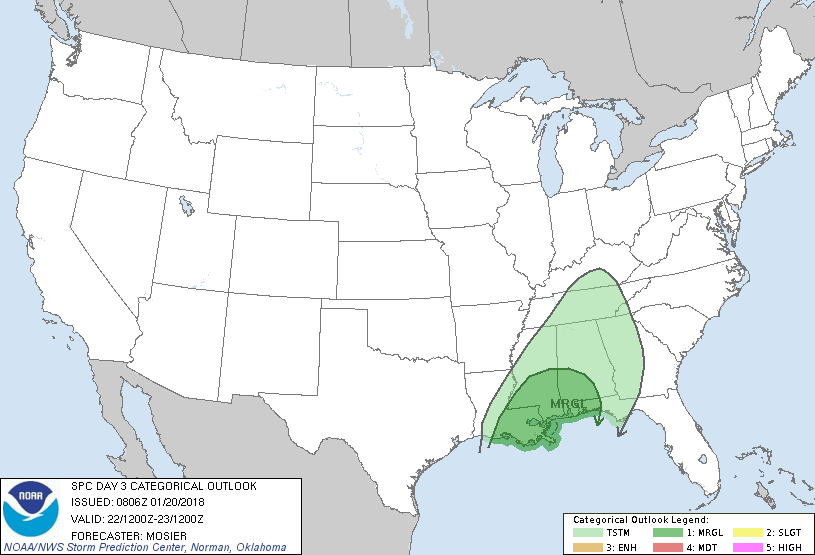
...THERE IS A MARGINAL RISK OF SEVERE THUNDERSTORMS ACROSS PORTIONS
OF THE SOUTHEAST...
...SUMMARY...
Isolated severe thunderstorms are possible as a cold front moves
through portions of the Southeast on Monday.
...Synopsis...
Mature cyclone centered over the central Plains at the beginning of
the period is expected to move northeastward through the middle MS
Valley into the Lower OH Valley during the period. At the same time,
attendant surface low will take a similar track just ahead of the
upper system while an associated cold front sweeps across the
Southeast. Warm sector ahead of this cold front will become
increasingly separated from the parent upper system over time.
However, a corridor of low 60s dewpoints and marginal instability
will still support thunderstorms across portions of the Southeast. A
severe storm or two is possible. Isolated thunderstorms are possible
as far north as the TN Valley where cooler temperatures aloft will
support marginal instability in the absence of better low-level
moisture.
...Portions of Southeast...
Thunderstorms will likely be ongoing at the beginning of the period
along and immediately behind a cold front expected to extend from
near MEM southwestward to near LCH. While the most unstable air will
remain offshore, enough instability will exist for thunderstorms to
persist along this front as it continues eastward through the
region. Given the strength of the wind fields, some of these storms
could produce damaging wind gusts. Primary uncertainty with this
forecast is the strength and persistence of any surface-based
updrafts, particularly given the anticipated speed of the front and
limited daytime heating.
..Mosier.. 01/20/2018
CLICK TO GET WUUS03 PTSDY3 PRODUCT
NOTE: THE NEXT DAY 3 OUTLOOK IS SCHEDULED BY 0830Z