SPC AC 180815
Day 3 Convective Outlook
NWS Storm Prediction Center Norman OK
0215 AM CST Sun Feb 18 2018
Valid 201200Z - 211200Z
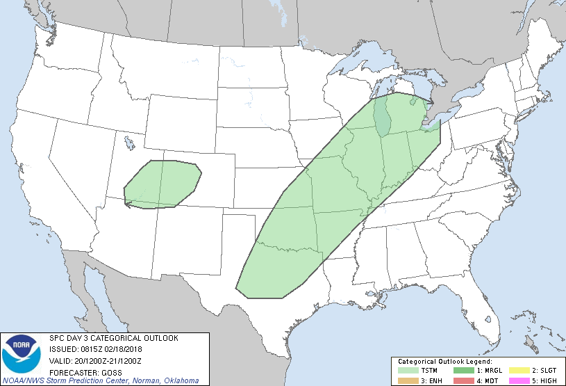
...NO SEVERE THUNDERSTORM AREAS FORECAST...
...SUMMARY...
Thunderstorms are forecast to occur from the southern Plains
northeast to the Great Lakes. Showers -- and possibly a couple of
lightning strikes -- may also occur over the Four Corners vicinity.
...Synopsis...
A highly amplified flow field aloft will remain over the U.S. this
period. Long-wave troughing will remain established over the
western half to two-thirds of the country, as one embedded
short-wave trough ejects northeast across the Plains but a second
digs southward across the northwestern states toward the Great Basin
-- thus resulting in quasi-stationary persistence of the long-wave
feature.
At the surface, cold polar air will continue spreading east and
southeast across western and central portions of the country. A
cold front at the leading edge of the cold surge will move east
across the Great Lakes/Midwest, and southeast across the Ozarks and
southern Plains through the period.
While showers -- and possibly a few lightning strikes -- are
expected over the Four Corners area, greater thunderstorm coverage
will remain associated with the advancing cold front, within a zone
from the southern Plains to the Great Lakes.
...Texas...
Showers and elevated thunderstorms are expected across much of
central and eastern Texas during the period. Some convection may be
ongoing early in the period, with more widespread precipitation
spreading southeast with time as the front advances. At this time,
it appears that thunderstorms associated with the advance of the
front across Texas during the second half of the period will be
largely -- if not almost entirely -- confined to the cool side of
the front. Confluent flow aloft, and a lack of mid-level height
falls, suggest that large-scale ascent should remain modest at best
through the deeper troposphere atop the warm sector. As such,
generally weak convection in an anafrontal-type regime is currently
expected, which should hinder appreciable severe risk.
..Goss.. 02/18/2018
CLICK TO GET WUUS03 PTSDY3 PRODUCT
NOTE: THE NEXT DAY 3 OUTLOOK IS SCHEDULED BY 0830Z
|